Big Sky

I love green.  I have an attachment, almost an affinity towards it.  I’m certain it comes from childhood when all of my outdoor gear was marked with green electrical tape.  I was the youngest of four and my parents were committed to giving us as many outdoor adventures as possible, despite their lack of resources.  We didn’t have a plane, or boat, or ATV, just an old Ford Station Wagon and an even older Coleman pop-up camper. 

Organizing camping, fishing, and hiking gear for four young kids takes ingenuity.  My parents devised a color-coding scheme to keep everything sorted.  My sister was red, my oldest brother was blue, my second oldest brother was yellow, and I was green.  To this day, when I receive a gift from my dad, it is marked with green tape.  Everything green is mine. 

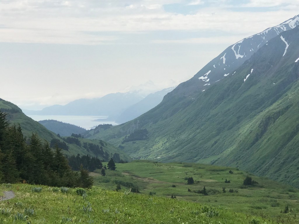
The same could be said for Montana.  It feels like mine.  I was born in Montana, at the Bozeman Deaconess Hospital, and I lived there for a grand total of six weeks.  My father was a school teacher and my mother stayed at home trying to survive four kids under age five.  It’s hard to feed a family of six on a teacher’s salary, so my dad headed north to Alaska, where the discovery of oil promised a better future.  When he found work, he sent for us.

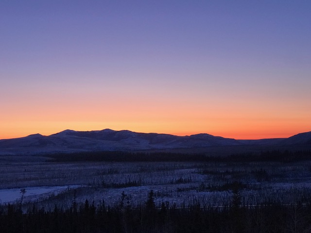
It broke my parent’s heart to leave Montana. They loved their life there: fishing in the Madison, hiking in the Spanish Peaks, and raising their young family in the rural country. Alaska turned out to be a pretty good trade off for Montana. My dad told the story about flying into Anchorage for the first time and seeing the Chugach mountains. “The first time I saw them, I knew we were going to be ok.”

The comforting Chugach

Alaska has been good to us, and I’m grateful for the sacrifices my parents made to bring us here, but Montana still holds a place of reverence in my parents memories.

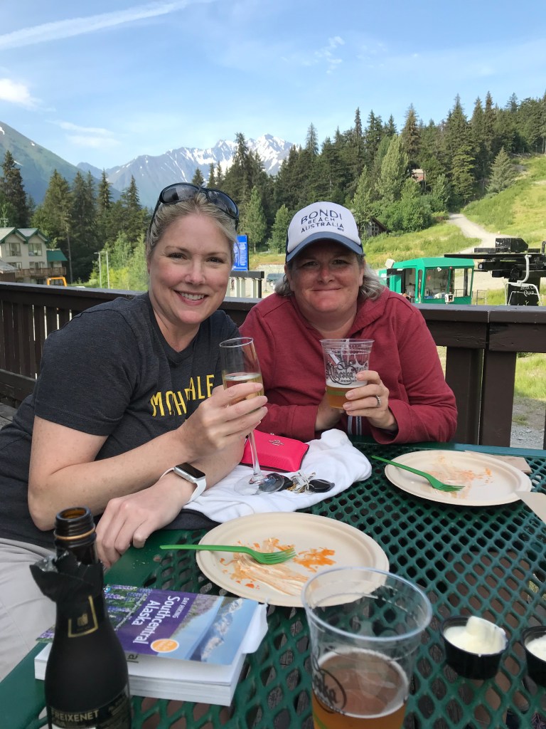
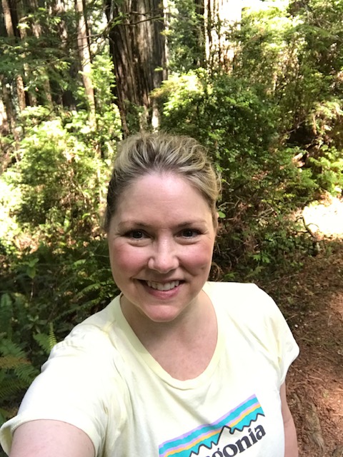
I’ve felt Montana calling for me for years; so, when my best friend Jenni and our friend Nancy suggested Montana as the next destination for a girl’s trip, I was thrilled.

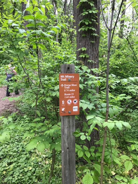
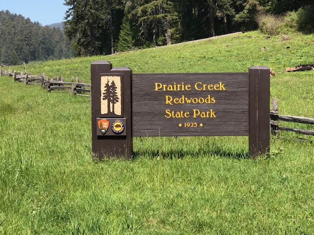
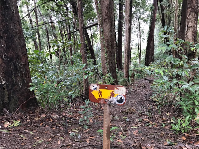
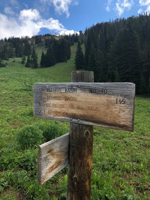
Nancy lived in Montana most of her life and has roots there.  She was our guide and suggested Big Sky.  Her logic, that Jenni and I were in lockstep with, was to balance the rugged outdoors with day spas and tempting restaurants.  The trip was planned months in advance, giving me plenty of time to research hiking trails.  All paths kept leading back to Beehive Basin in the Gallatin National Forest. 

Beehive Basin: 7.1 miles round trip and a gain of 1,650 ft.

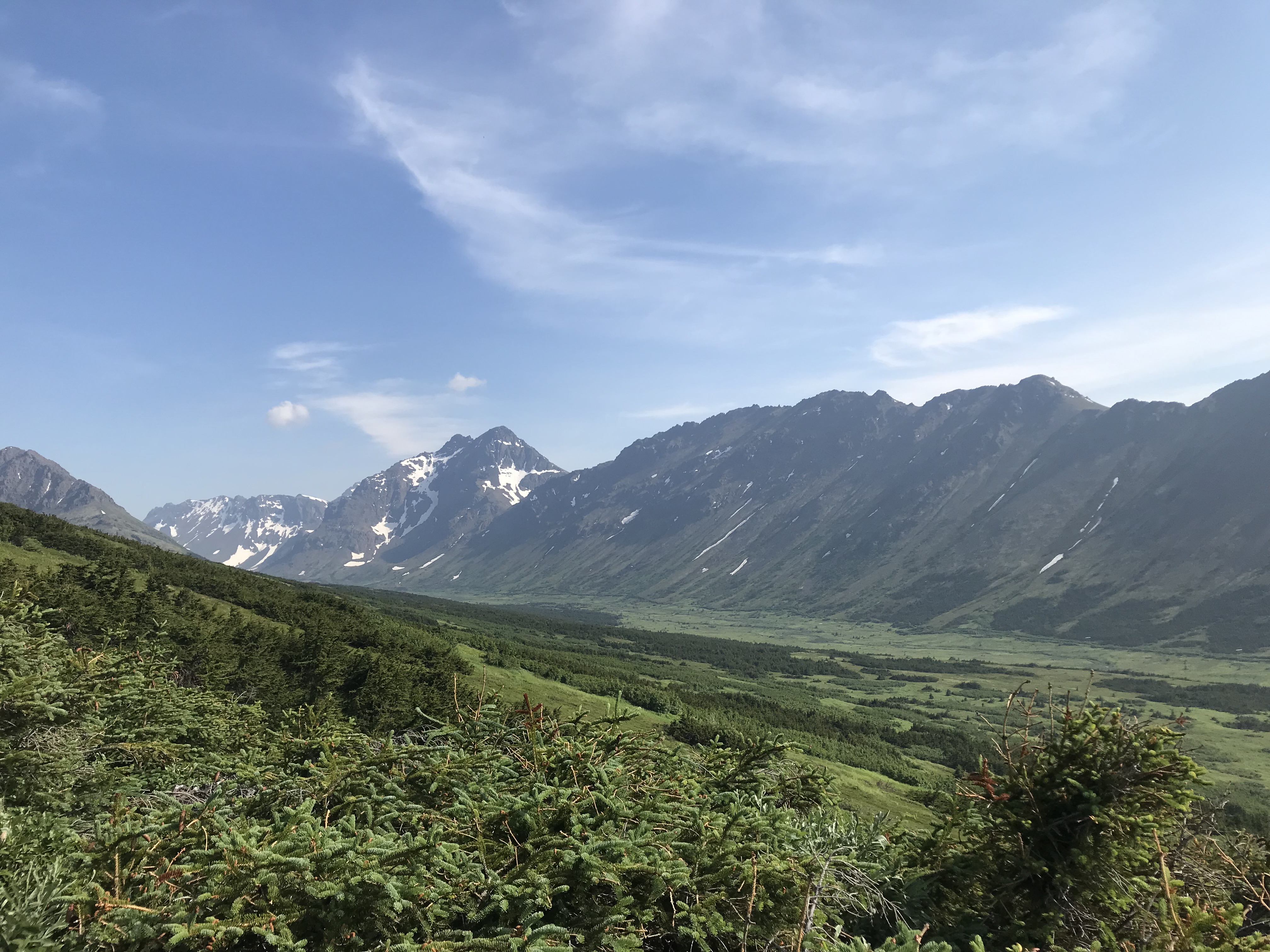
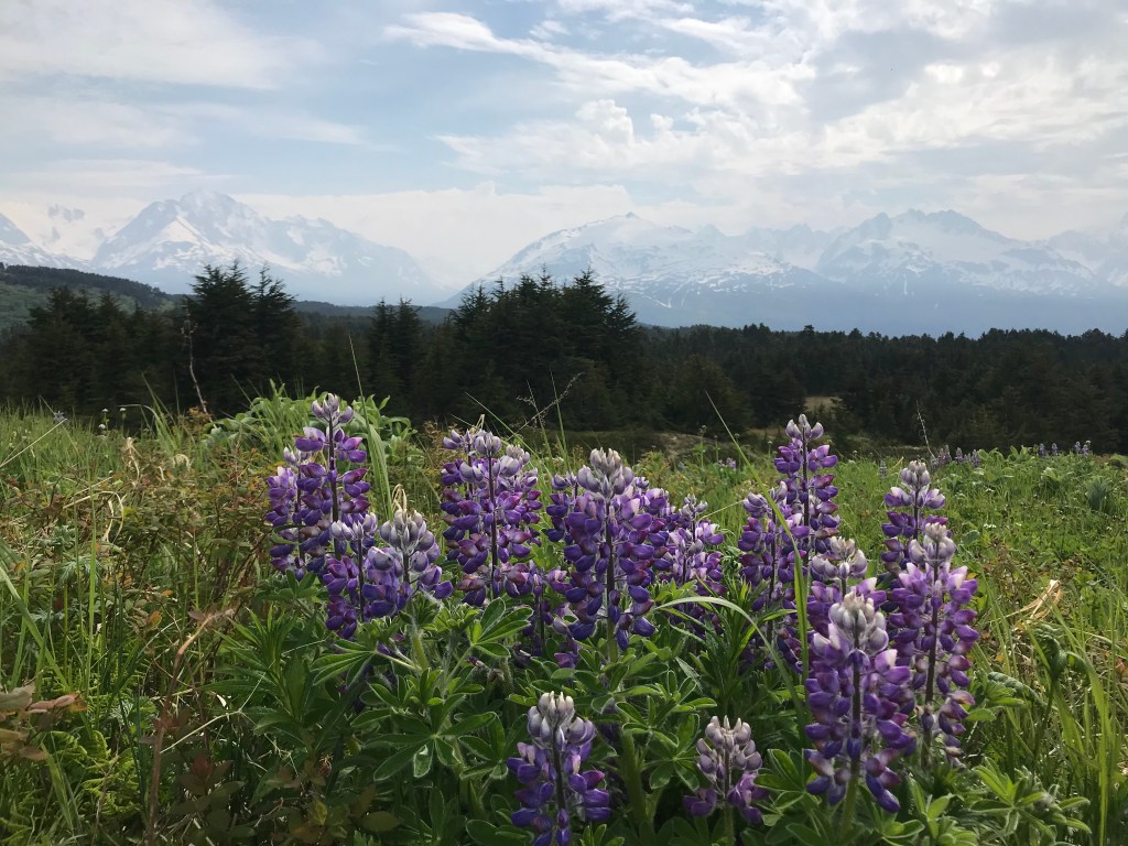
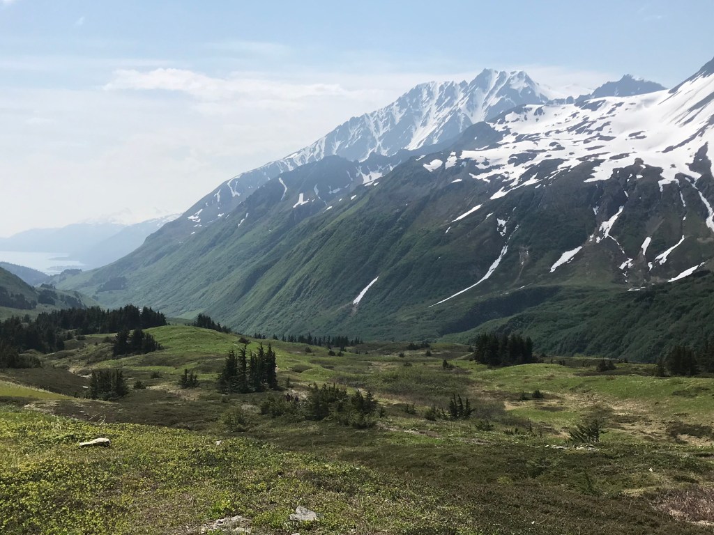
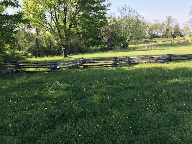
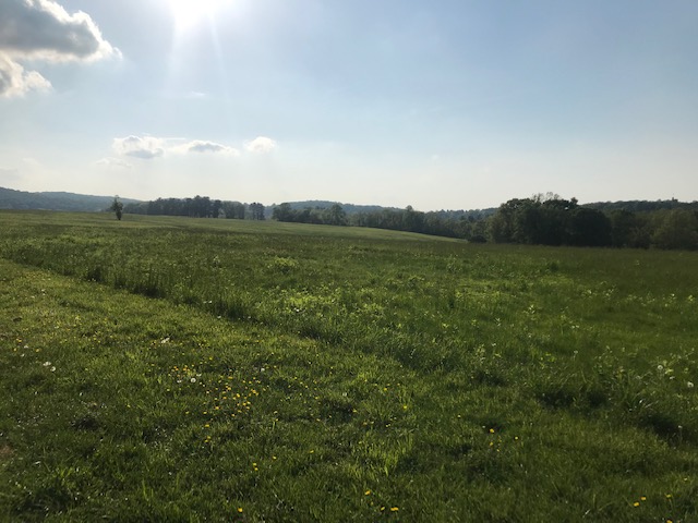
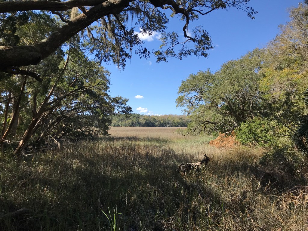
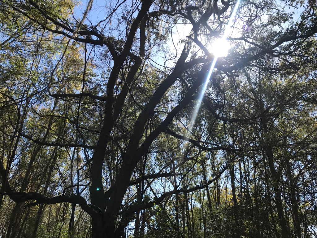
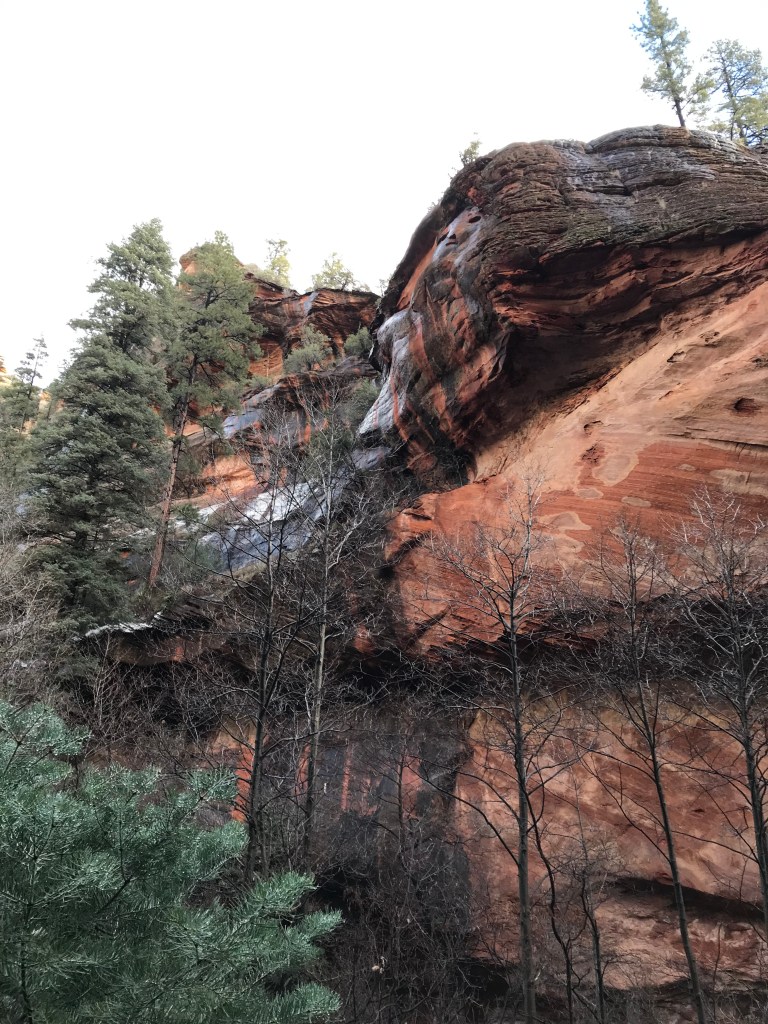
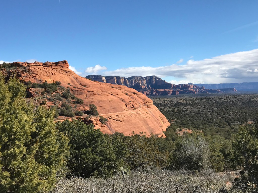
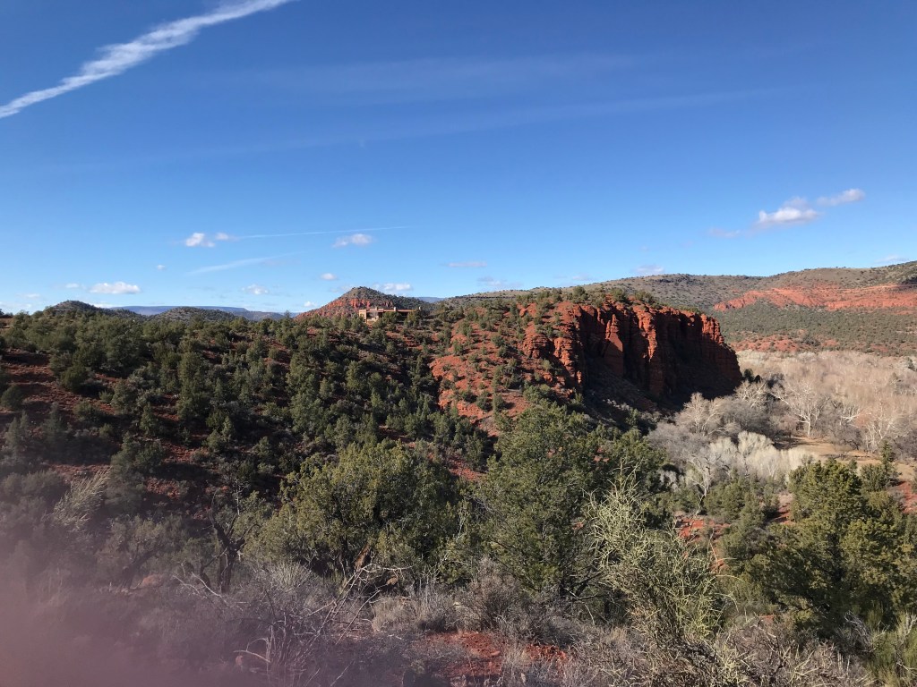
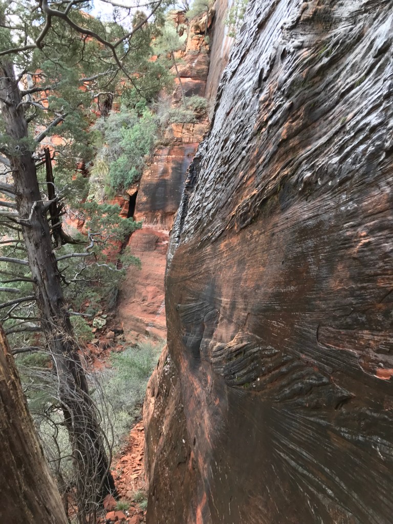
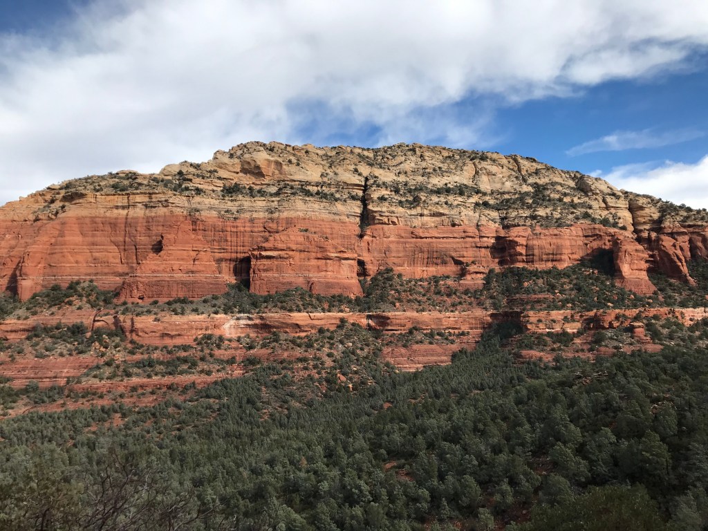
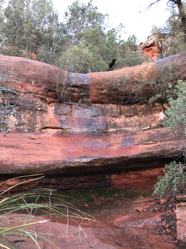
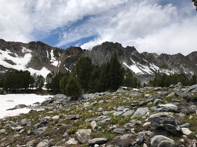
The morning after we arrived in Big Sky, we were winding our way up Highway 64 through the Spanish Peaks.  Coming from Alaska, it’s hard to be impressed by mountains, but there’s something different about the Spanish Peaks.  They feel old. The bright, granite-looking rock faces dotted with pines and bright green prairie grass makes you feel like you’re in Hollywood’s wild west.  John Wayne is going to come riding up at any moment with tip of the hat and a “morn’n ma’am.” 

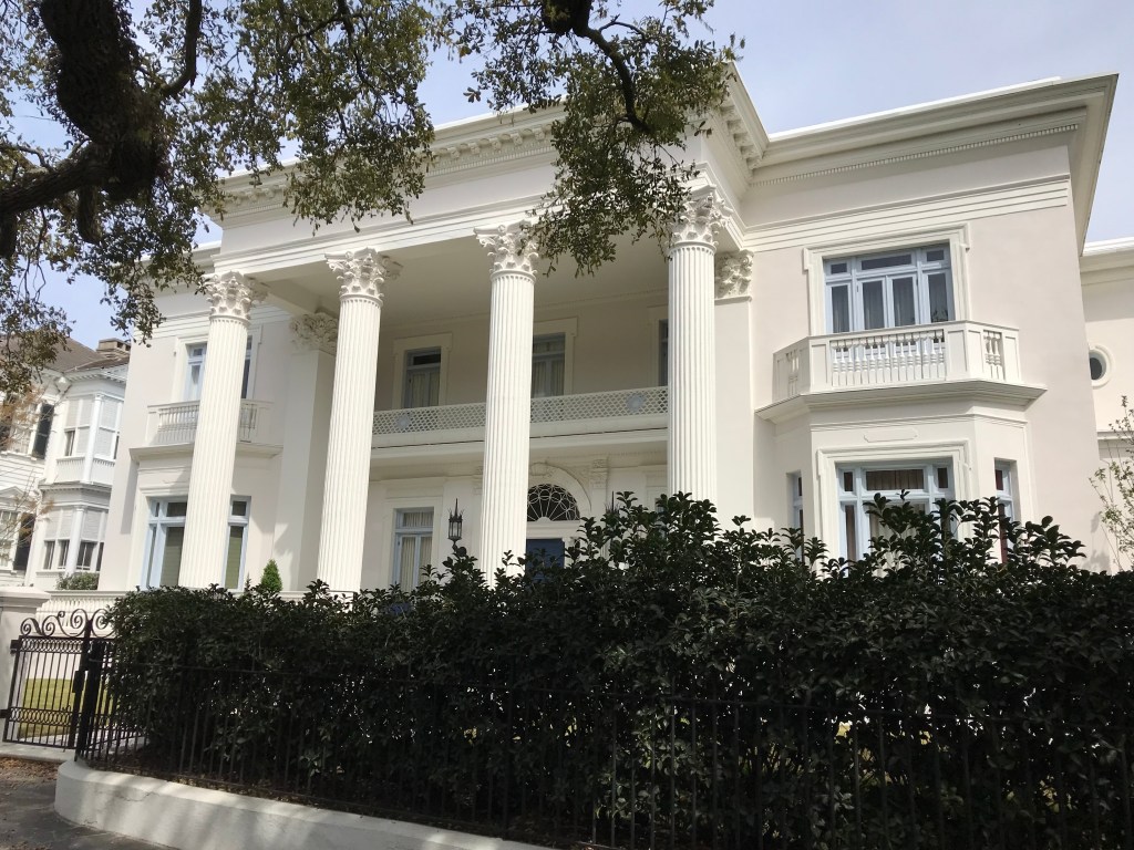
The closer we got to the trailhead, the more disappointed I became.  The rugged and wild Montana of my childhood dreams was now the luxurious West, bought and shaped by billionaires, whose multi-million-dollar monstrosities, designed to look like alpine chalets crossed with rustic log cabins, saturated the landscape.  I just wanted to hike, to go on this epic hike in this wilderness palace so intertwined with my family’s history and share it all with my dear friends, but I was overwhelmed with inferiority.  I didn’t belong and never will.   

I’m an American, I should feel like I belong in any National Park.  It’s mine, it’s yours, you know “…this land is your land, this land is my land”?   Not true in Big Sky, Montana.  That land belongs to the 1%.  Sinking the knife in deeper is the fact that these pseudo outdoorsmen (I know, that’s judgey and a tad harsh.) only grace their faux-cabin chalets once or twice a year, and they sit empty the remaining time, just taunting the other 99%.  My expectations hit a brick wall and shattered.  Just like the author, Anne Lamott said “Expectations are resentments under construction.”  It’s best to keep your expectations in check and wait for the beautiful surprise.  It was time to do an attitude about-face and rescue myself from the bitter spiral.  “Where did I go wrong?  Why don’t I have a faux-cabin chalet?  What’s my 401K up to today?”

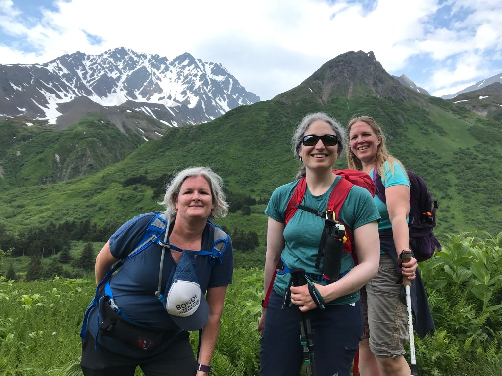
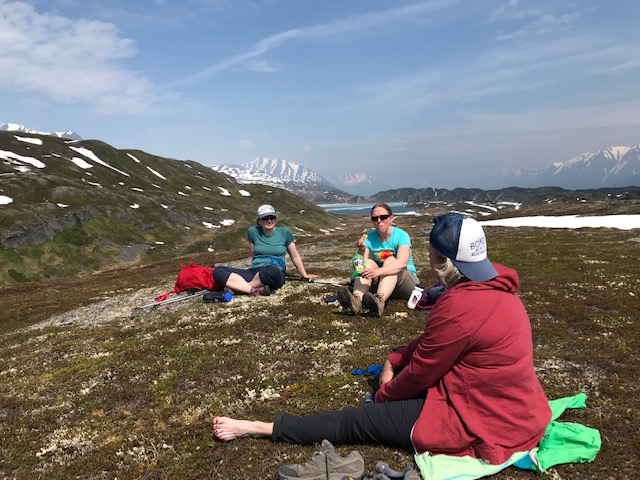
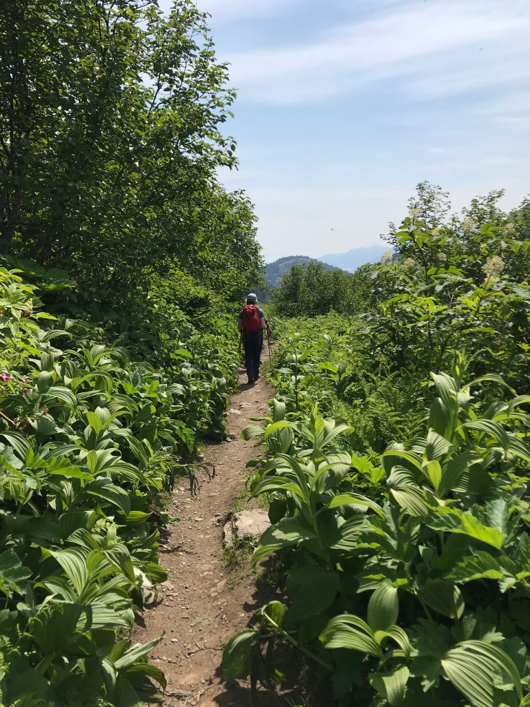
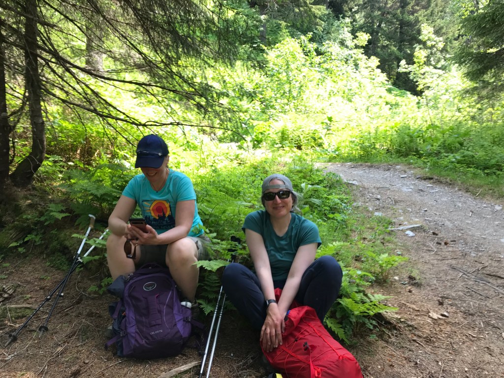
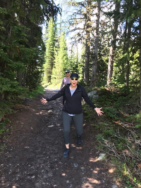
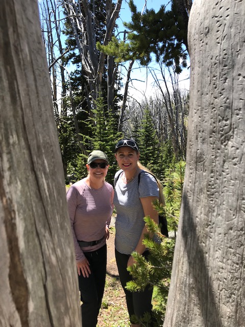
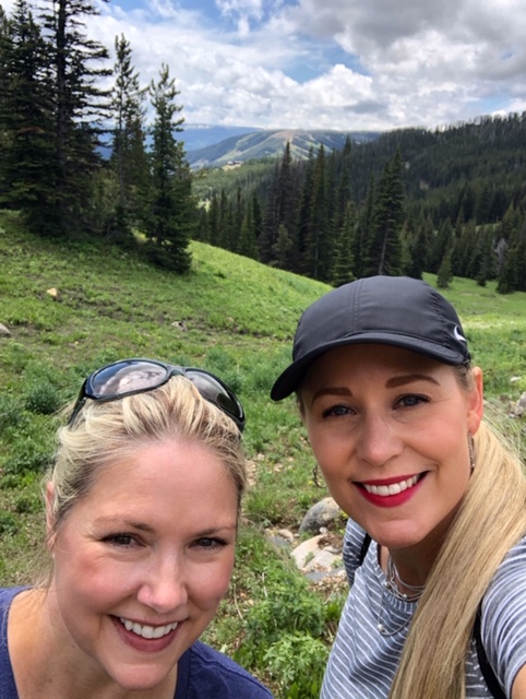
Stepping on to the Beehive Basin trail is an immediate lift for any funk.  To make it even better, my two dear friends were along for the adventure.  While Nancy is comfortable in the outdoors, it’s not Jenni’s favorite thing to do.  It’s dirty, there are bugs, there’s no Starbucks, and it’s just not her jam.  The fact that Jenni was on board for this hike, made me feel very honored and grateful.  And while it may not be her jam, once Jenni sets her mind to something, it is going to happen.  She’s as strong and stubborn as I am. 
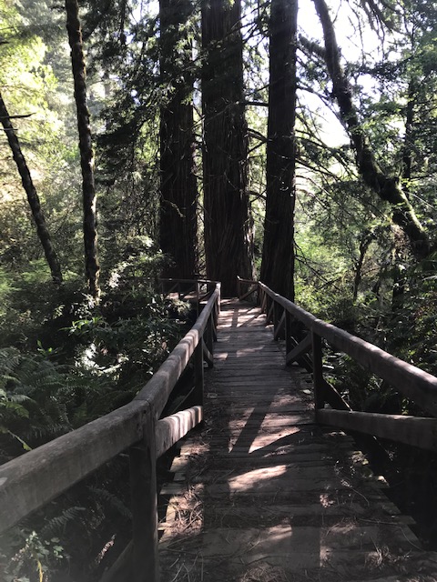
The Hike

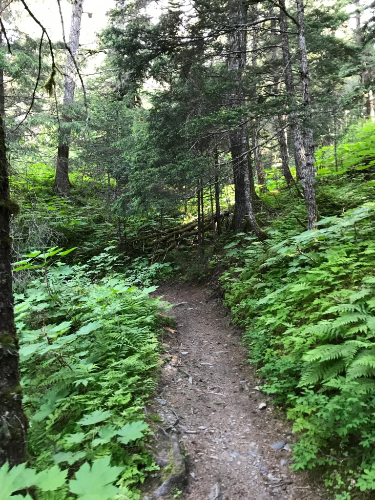
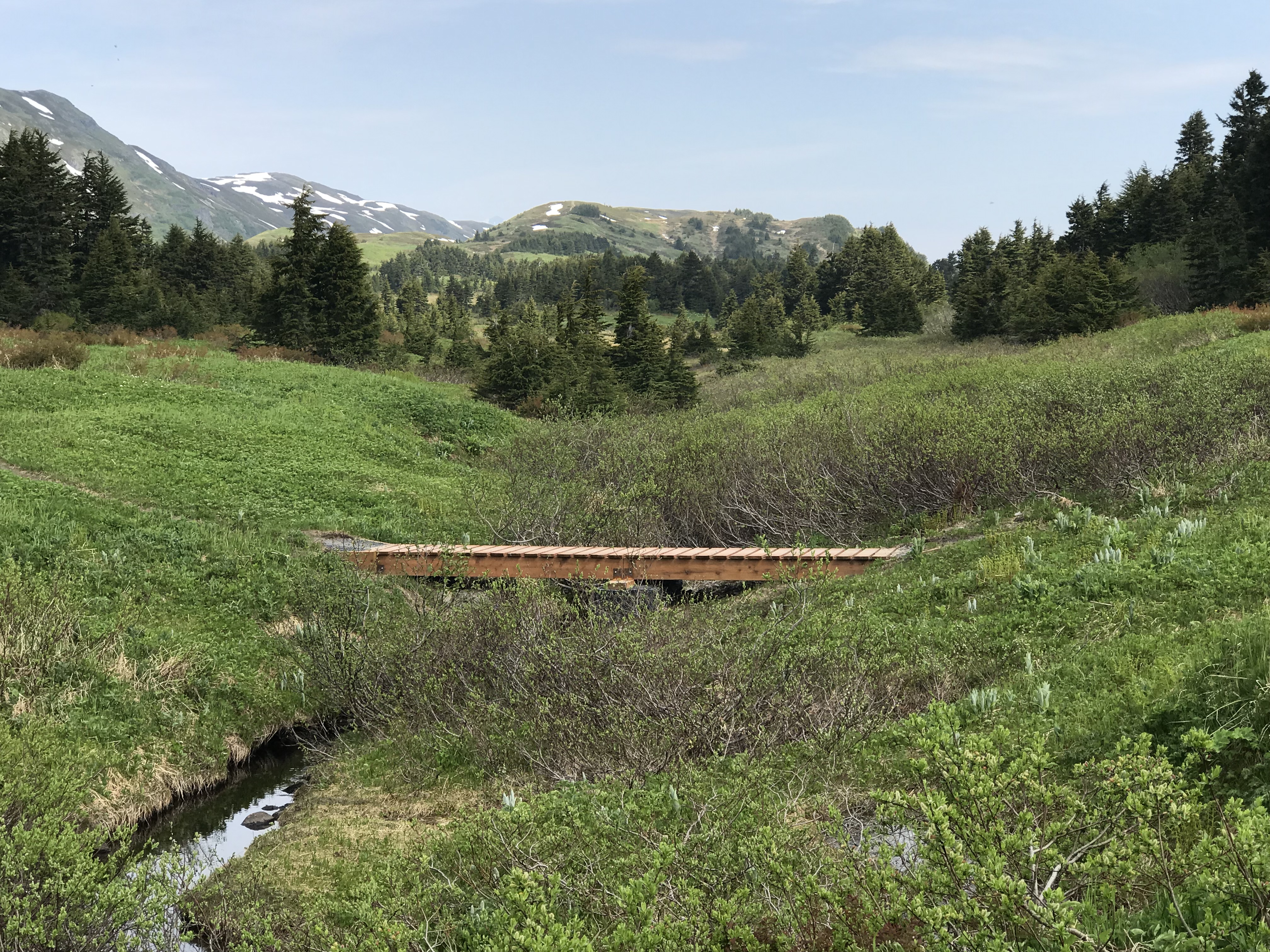
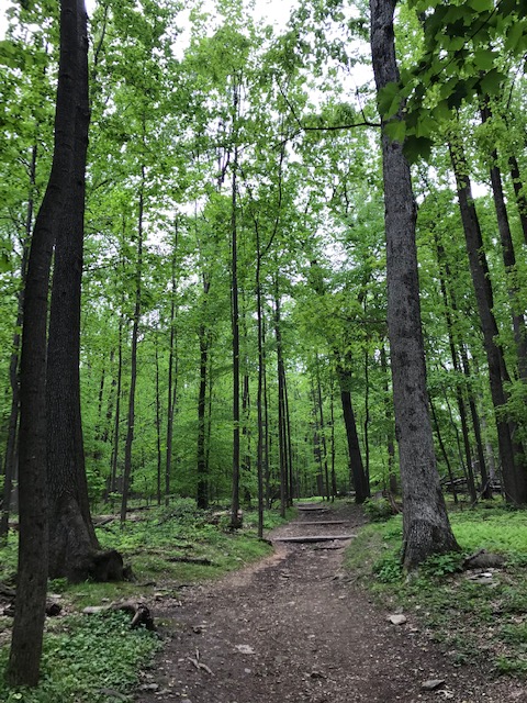
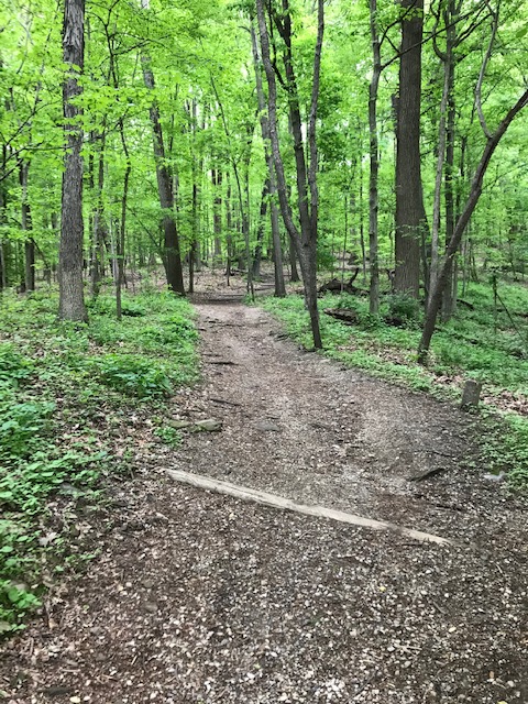
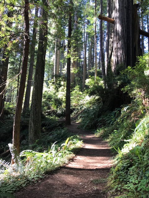
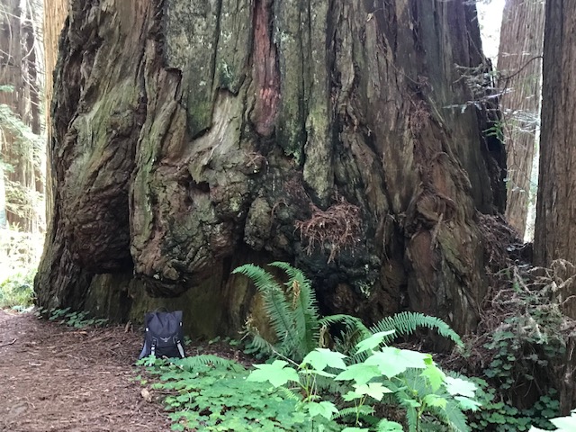
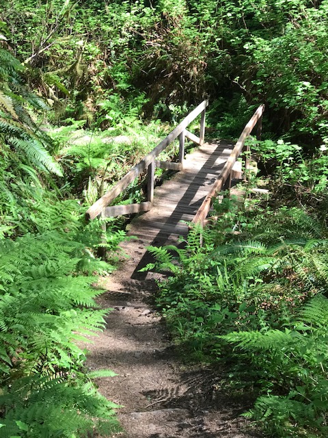
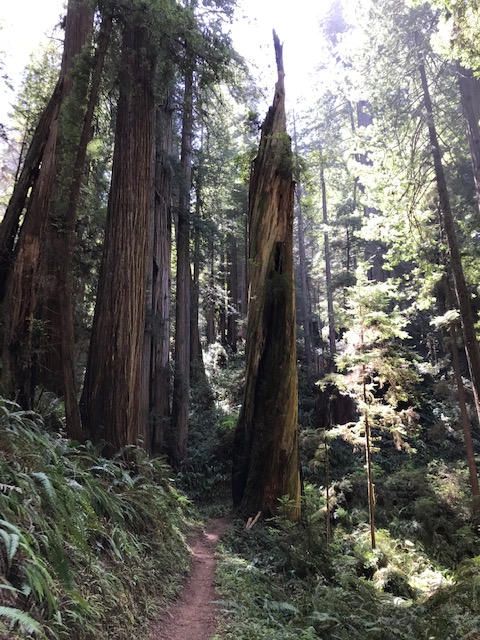
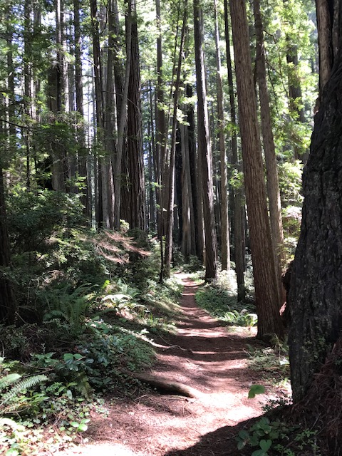
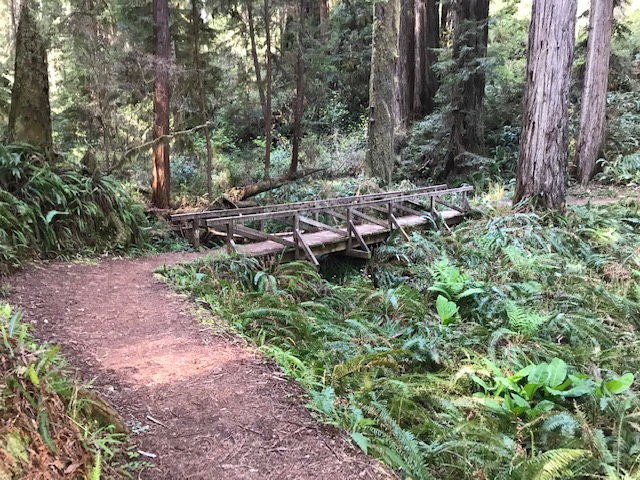
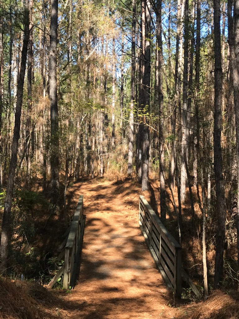
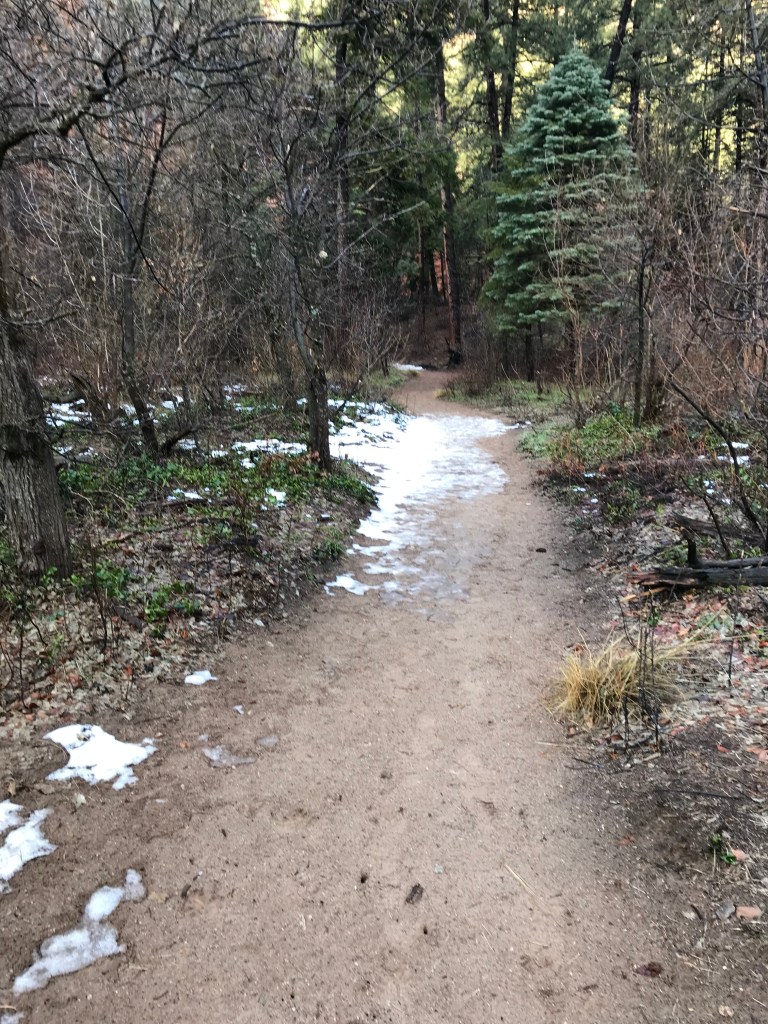
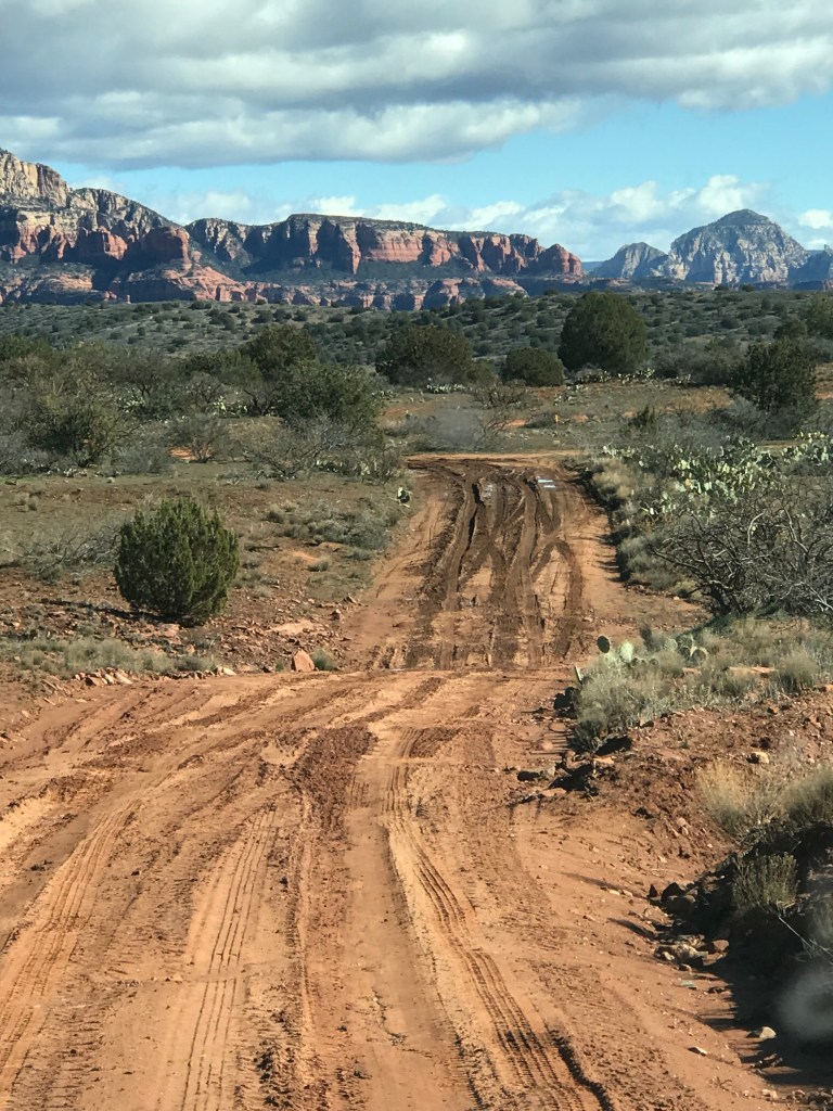
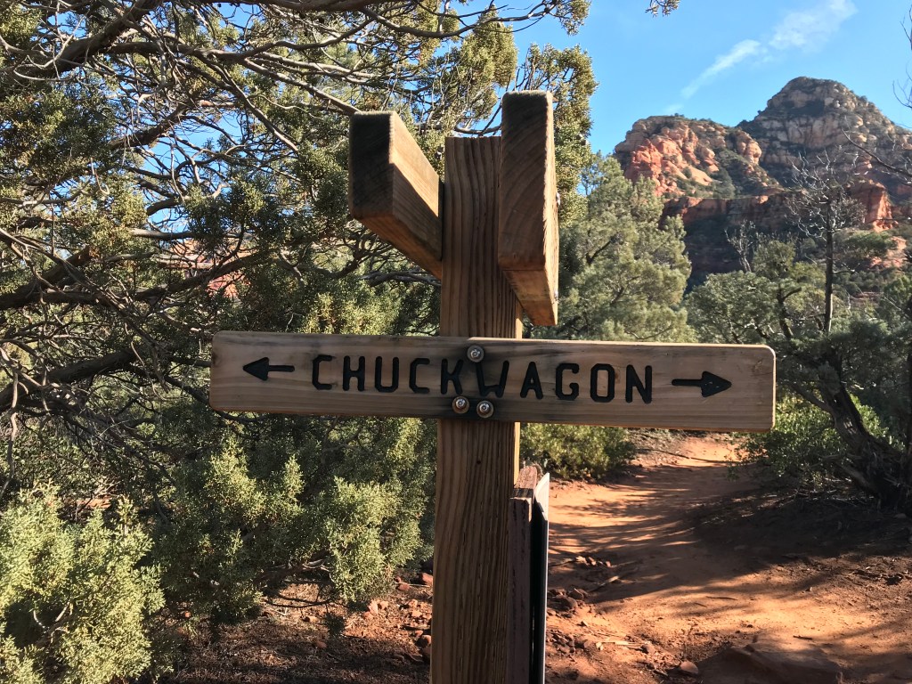
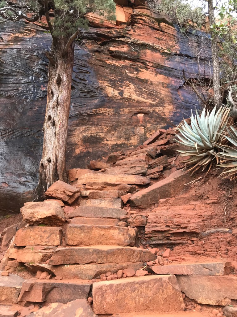
The trail begins in a valley next to a creek and cuts in along the side of a hill for a slight but steady climb. You can still see a few humbling homes (not humble homes), but before long you get to the switchbacks and enter the Gallatin National Forest, leaving the 1% behind.  

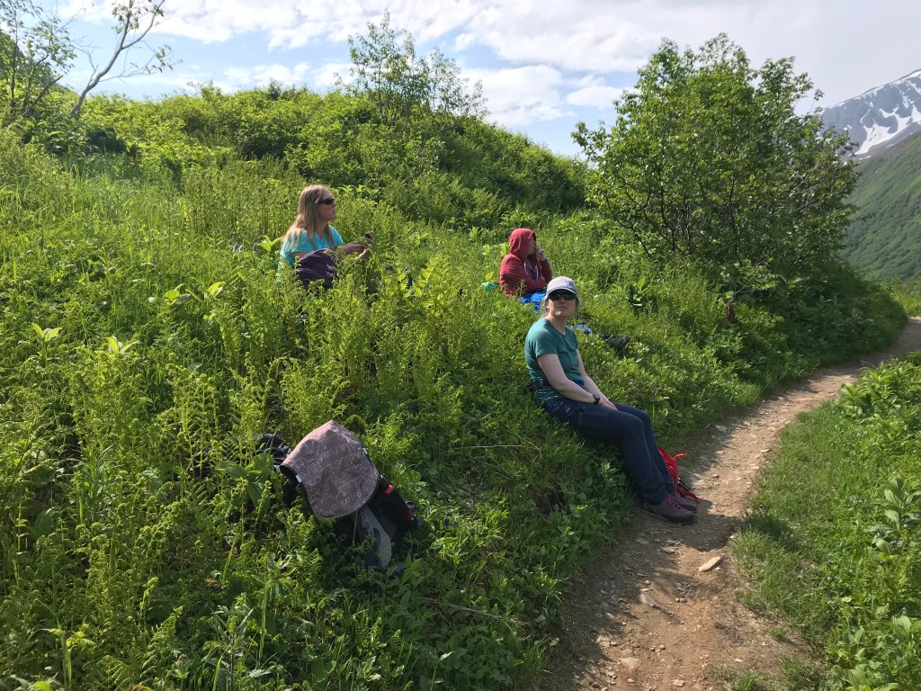
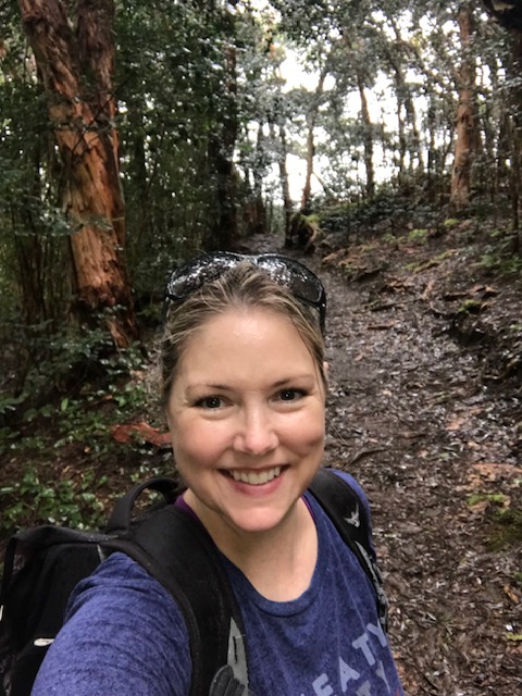
It was right about here that I started to notice that I wasn’t hitting my stride.  I’m typically a little stiff and winded when I start a hike and then I hit my second gear.  Jenni said “Damn, I didn’t think I was this out of shape.”  She’s not and wasn’t.  I had been hiking all year, I should have felt better.  Nancy seemed fine, she’s in great shape and weighs like 90 lbs. soaking wet.  I was struggling and we hadn’t reached any notable incline.  My legs were heavy and my breaths were shallow.  This was embarrassing, especially for an avid Alaskan hiker.

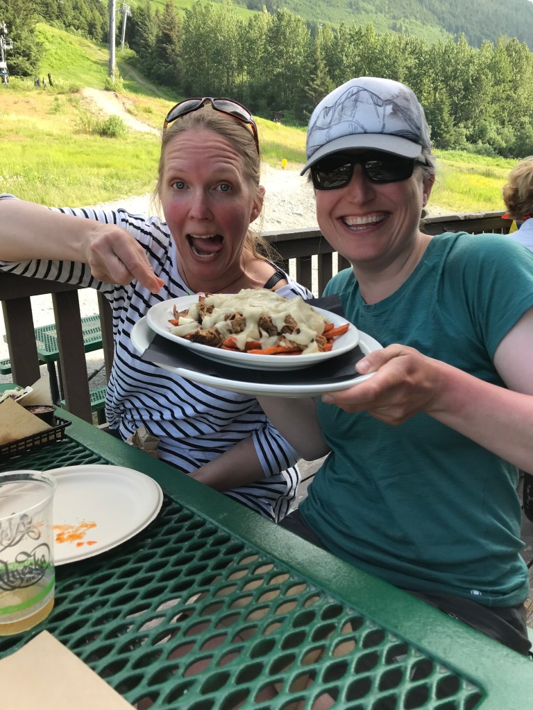
It wasn’t until later, surrounded by nachos and beer, that we realized we had climbed up to just under 9,000 ft in elevation.  All of my hikes in the Chugach start at sea level.  It never occurred to me to check the elevation in Big Sky, which I now know sits at 7,218’.  Jenni and I both felt better.  

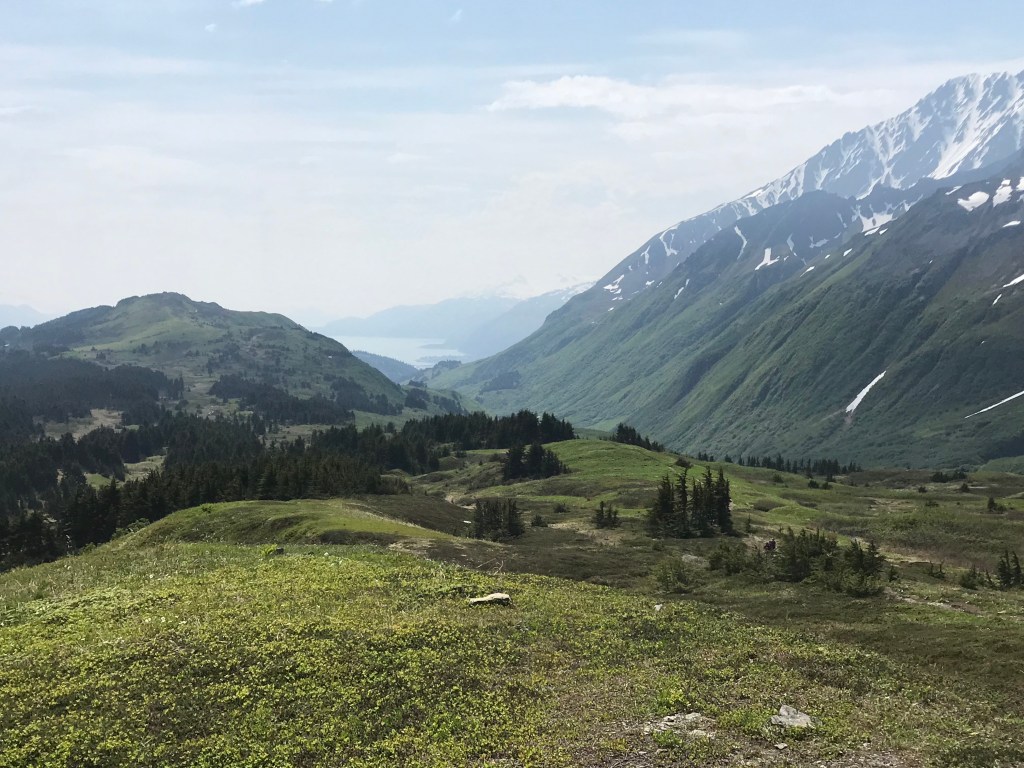
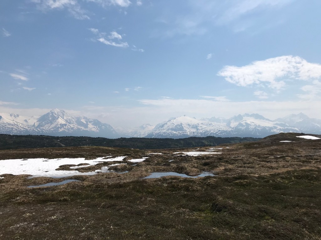
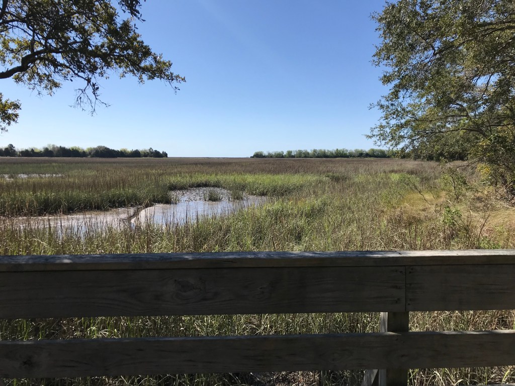
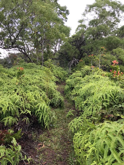
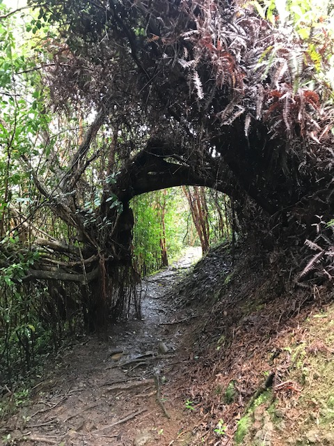
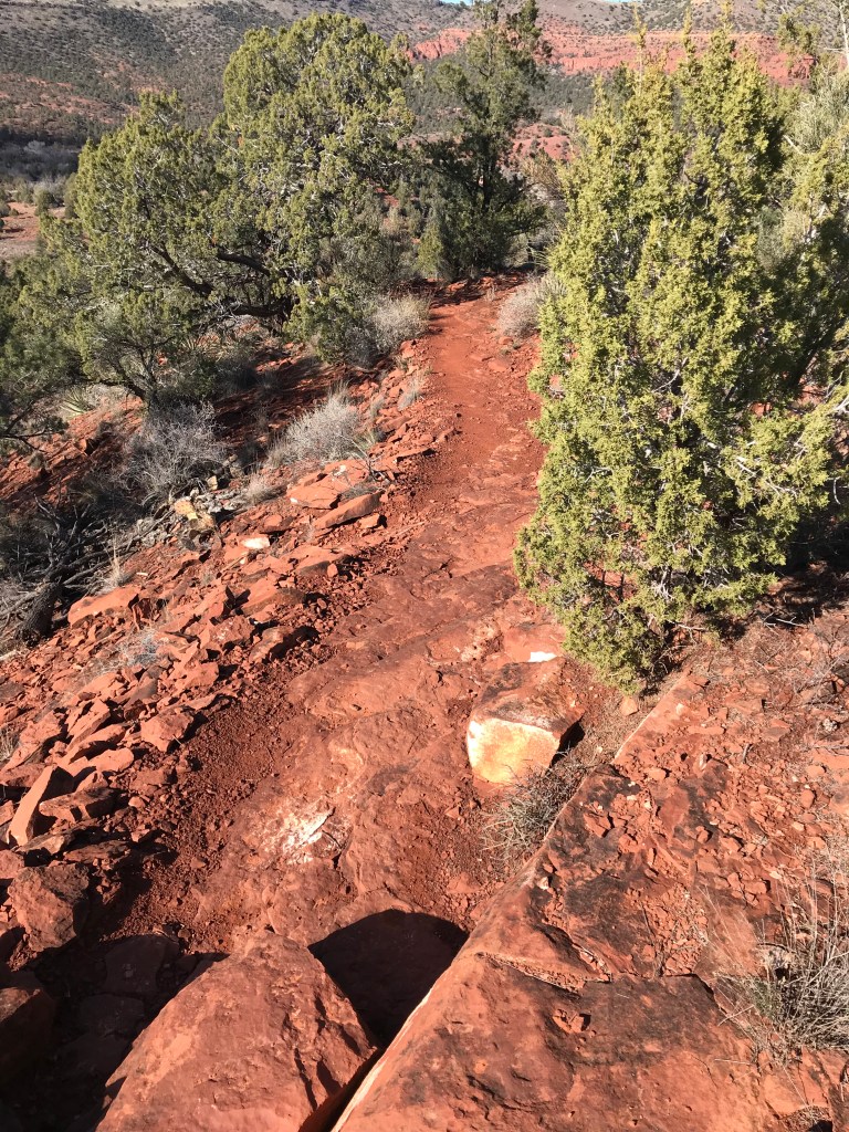
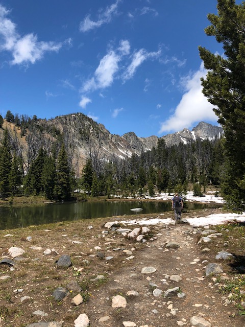
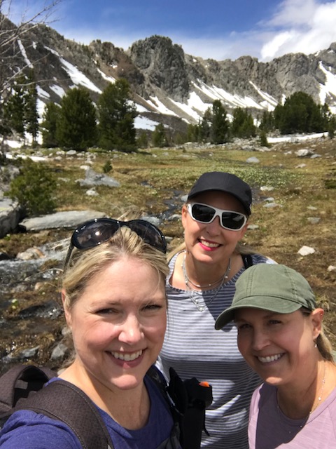
The switchbacks were moderate and before long you reach the valley.  To just be in the valley felt like a reward.  To be surround by the Spanish Peaks felt like home. 

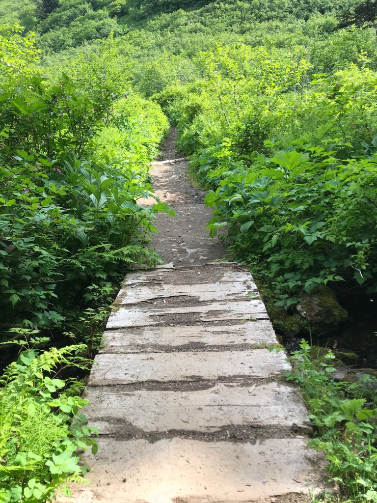
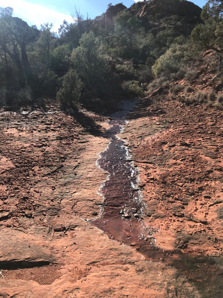
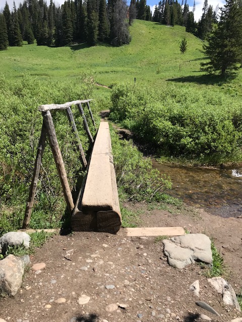
We pressed on, fording streams, and refueling with peanut m&ms.  It was a beautiful day.  We never stopped talking and laughing.  As much as I treasure my adventures in solitude, I am always overwhelmed with the joy of a shared experience with true friends. 

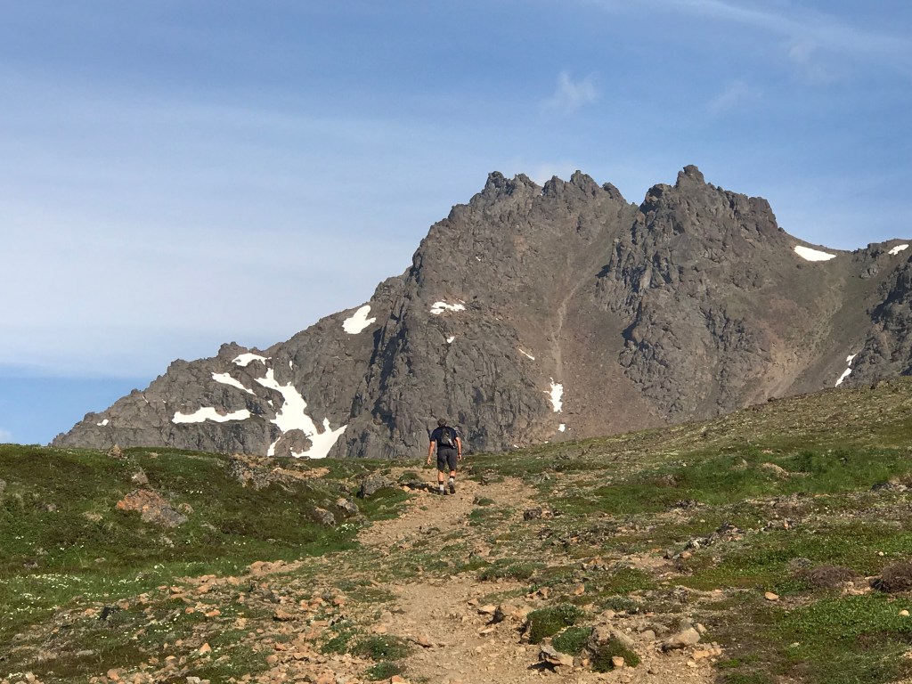
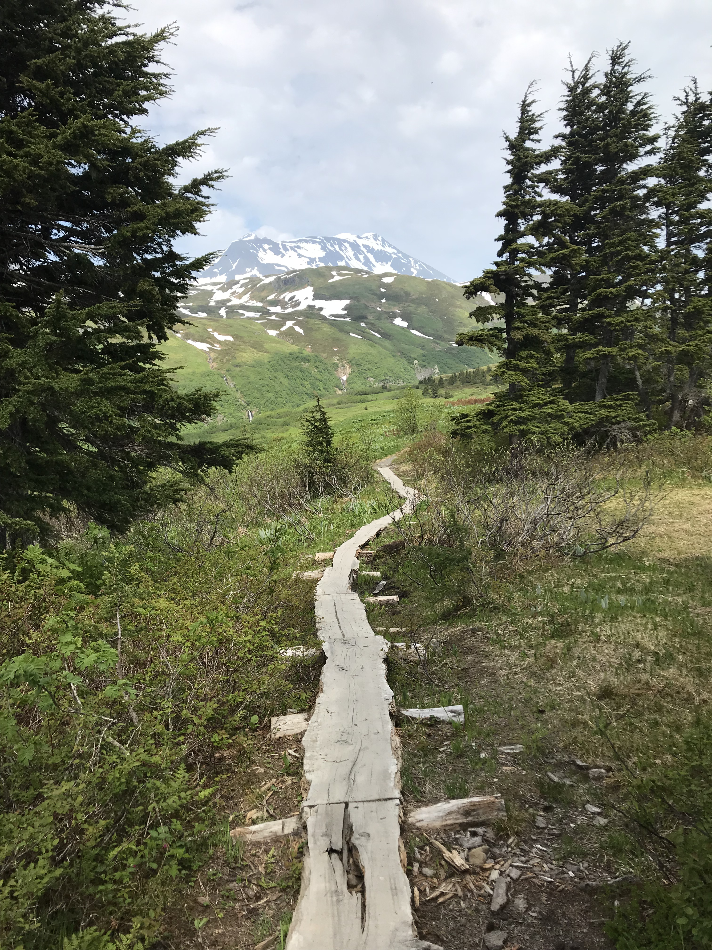
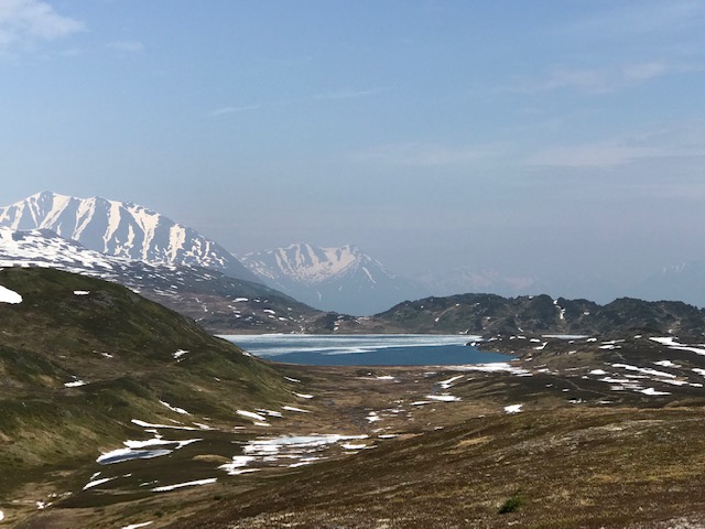
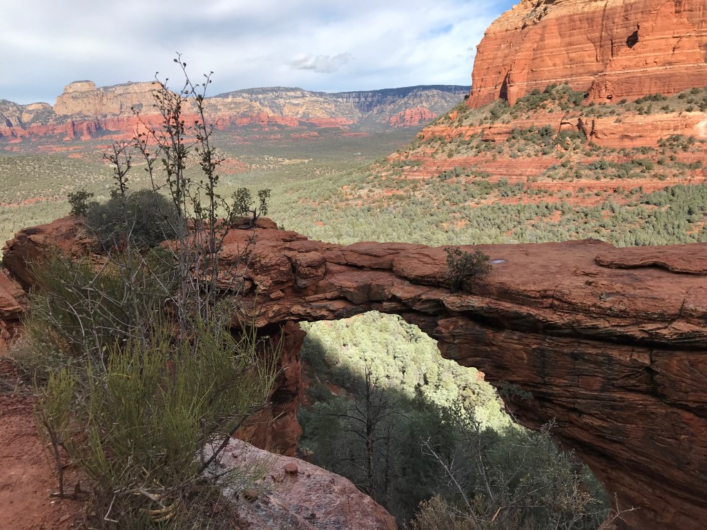
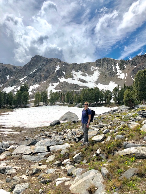
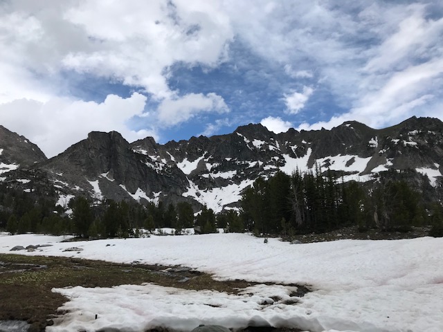
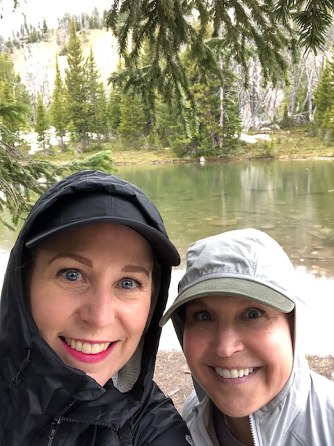
The far end of the valley gave way to our final climb up to the basin.  Once we reached the basin, we were battling the snow which surprised me because it was July and I, of course, had no idea we were over 8,000’. 

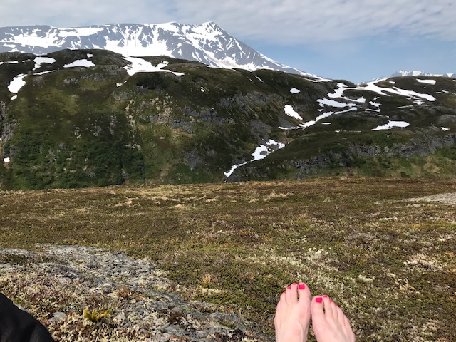
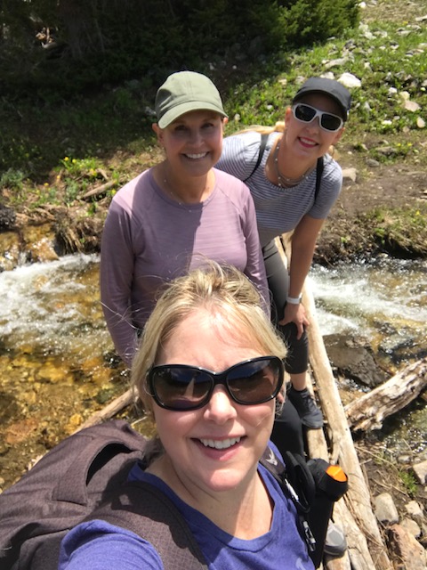
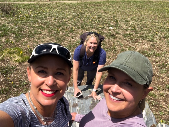
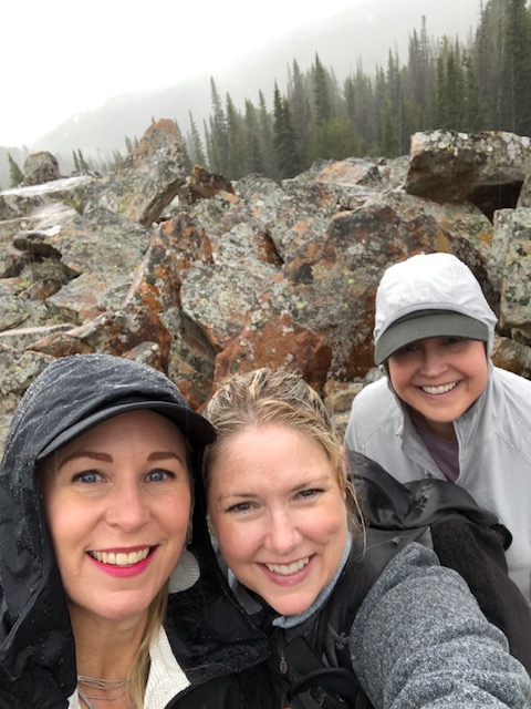
There was a lake both Nancy and I wanted to get a glimpse of, so we pressed on through the snow.  Jenni was game, but didn’t have the best traction on her shoes.  We circled back for Jenni, took our selfies, and headed back down the mountain.  And not a moment too soon.

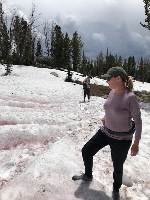
The afternoon thunderheads were rolling in, and the rain and lightning were not far behind.  It was time to get off the mountain. We hustled our tired and shaky legs down the trail as fast as we could. 

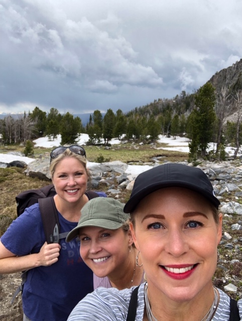
Despite being faced with imminent danger, we blissfully descended while chattering away, solving each other’s problems.  Back in the car, soaking wet and hungry, we wound our way down through the community of one percenters.   I felt rich, and lucky, and happy.

Jenni and I look quite close, but really it was just my turn to push the button. It’s a process.

 It’s been months since I went on this hike.  (Yes, Jim, I know I’m late on the blog.)  I’ve had some major changes in my life since my trip to Montana.  I took a job for less money.  I lost my beloved Kitty. And I changed my priorities.  I think it comes down to how you measure wealth. 

If I continue to use the “faux-cabin chalet” as my yardstick for achievement, I will be constructing resentments for the rest of my days.  I choose to shift my perspective, to rescue my expectations, and define wealth in the immeasurable.  I will define my wealth by the fact that I am just as excited to go home as I am to go on vacation.

Bogey and Kitty, the heart of my home.

I make less money now, but I am out of my office that was a box within a box in a corporate structure that made me feel constantly anxious and irrelevant.  I now work in a place that tourists pay thousands of dollars just to glimpse for a moment, and in a job that rewards and challenges me every day. 

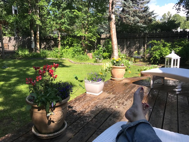
I will measure my worth, sitting on the back deck of my tiny but charming house, that I bought by myself, surrounded by flowers I grew from seed and planted with my own two hands. 

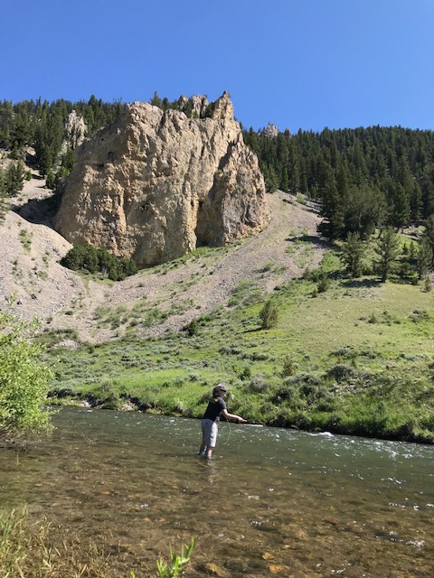
I will measure my inheritance each time I take out the flyrod still wrapped with green electrical tape, and practice that roll cast my dad taught me.

The Gallatin River. Thanks, Sarah.

Most importantly, I will measure my wealth by the company that I keep, the friends who are always there for me.  The friends who go hiking with me at 7,200 feet, maybe thinking at every step that there’s somewhere else they’d rather be, but they keep climbing, because that’s what friends do. 

That’s how I’ll measure my wealth.  

Shout Outs

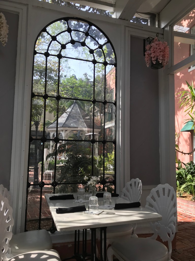
If you’re going to visit Big Sky, Montana, bring along some great friends and definitely make an appointment at Santosha Wellness Center. It’s an unpretentious and authentic day spa that includes yoga, healing arts, and is home the best facial I’ve ever had.

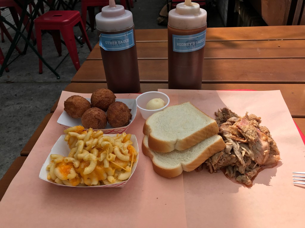
A place I would have eaten at more than once was the Gallatin Riverhouse Grill which sits along side the Gallatin River and has some incredible BBQ. There’s a bit of a wait, but it’s worth it.

If you want to go fishing but forgot your gear, the guys at Gallatin River Guides will hook you up, and shamelessly flirt with you. Good gear and an ego boost!

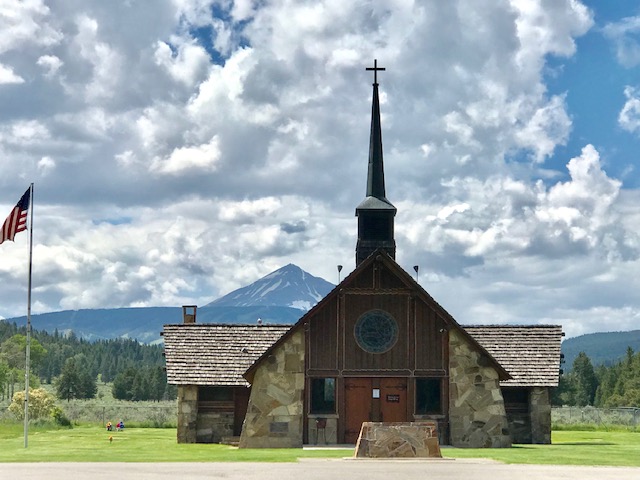
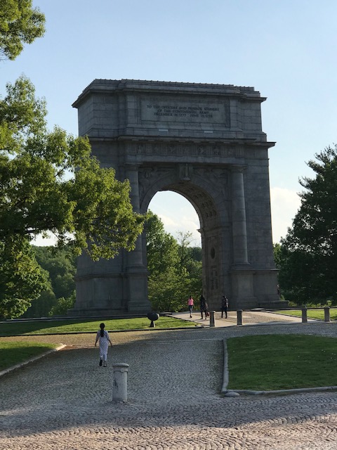
And a place not to be missed is the Soldier’s Chapel, just off Highway 191. This memorial chapel was built by the Story family to honor Nelson Story, IV, and the fallen men of the 163 Infantry who gave their lives in World War II. It’s a small and humble chapel surrounded by a magnificent cathedral with Lone Peak as its spire.

The Soldiers Chapel

Lost Lake Trail: A Celebration of Solstice

At the top, looking back on Resurrection Bay

I never get tired of the mountains, they always leave me awestruck and humbled. Alaska has no shortage of awe inspiring peaks. We are home to four of the top ten tallest peaks in North America: Mt. Bona -16,550′, Mt. Foraker -17,400′, Mt. Saint Elias -18,009′, and of course the tallest peak in North America, Denali -20,310′. I won’t be hiking any of them -ever. I’m looking for something a little more accessible and less deathly. Let’s hear it for the Chugach!

Glenn Alps in the Chugach are the closest and most popular access point for Anchorage residents.

The Chugach mountains envelope Anchorage and stretch approximately 300 miles east to west over South Central Alaska. They are the exquisite playground to Alaskans living in the state’s most populated region, and easily accessible for a weekend adventure or an after-work hike. Since my goal for this project is to hike a trail I have never hiked before, I chose Lost Lake Trail in the Chugach National Forest. Many of my fellow Alaskans have hiked, biked, and ran this trail. I’ve heard about it my whole life, but knew it wasn’t something I would do by myself. Even though it’s a popular trail, the thought of running into a bear by myself paralyzed me with fear. Bears are everywhere in Alaska! You have to plan ahead, be smart, and work hard to avoid them. They don’t want to meet me on the trail anymore than I want to meet them. The best bear management plan is to make a lot of noise to minimize surprise! You need friends for this!

Friends with pepper spray are the best kind of friends!

Hiking alone is usually my only option. My friends are busy, they have demanding careers just like mine, and on top of that they have families that are their top priority. I was thrilled when all the stars and schedules aligned to give me the opportunity to hike with my friends Alex, Katriina, and Trudy. Not only did they have the entire Saturday to hike with me, it was the weekend of Summer Solstice! While Summer Solstice is sacred in many places and cultures, it is truly something special in Alaska. It marks the peak of summer, the longest day of the year and it deserves to be celebrated. Alaskans rush to the ocean, rivers, mountains, and festivals to make their offerings and honor the gods of summer. It’s a celebration of the blessings we have as Alaskans, the pride we share, and the somewhat somber recognition that after solstice, the daylight begins to fade a little every day until we find ourselves in the darkness of winter. There is always pressure to “make the most of solstice.” We did just that on this extraordinary hike.

From left to right: Trudy, Alex, and Katriina

The Hike

There are two options to access Lost Lake, both are about a two hour drive south of Anchorage on the Seward Highway. You can thru hike this trail from either the Primrose Trailhead or the Lost Lake Trailhead which is closer to Seward. If you choose to thru hike it, you would be hiking for about 15 miles. You can also hike into the lake and back out the same direction. We chose to hike in and out on the Last Lake side closest to Seward so we could get above the tree line faster.

The trail takes you through a dense forest for the first couple of miles.

We started our hike about 9:00 a.m. and the temperature was perfect (for Alaskans that would be low 60s). We moved at a good pace, talking and laughing, and reveling in our responsibility-free day. The sun was out and the wind had changed direction just enough to clear out the smoke from the nearby forest fire. It was truly an epic Alaskan day, a gift.

It’s a steady but moderate climb to the plateau overlooking the lake. The elevation gain was a respectable 2,500 feet, not enough elevation to affect your oxygen levels, but just enough to make you feel like you accomplished something.

A short break at mile 3

When you make your way out of the trees you are treated to open meadows and a flatter trail.

Just when you think the views can’t get anymore spectacular, you realize Alaska still has something to show you. At every jaw-dropping vista we stopped to photograph, it was if the Chugach was shouting down at us “You think that’s special? Here, hold my beer!” Around the next corner we would stop again and try to take pictures that could never fully capture what we were seeing in that moment.

We stopped at the plateau overlooking the lake to rest our tired feet and refuel for the six mile descent. It was almost surreal to sit on the top of a mountain and still be surrounded by higher peaks.

The hike down was quicker and offered a different perspective. The temperature was climbing and the trail was quickly becoming crowded with bikers and hikers. Katriina was in front, chatting up all of them. She frequently reported back on their trail etiquette, and identified the men she thought were suitable for me to date. Thanks, Katriina. When she encountered a man with a pair of binoculars around his neck, she asked him if he had spotted anything, to which he replied “nothing extraordinary.” We were all a little surprised at his response since we were surrounded by everything extraordinary. She rightly informed me that he was completely undateable as he was obviously impossible to please.

Not too “death marchy” as Alex would say
Almost done and looking forward to a cold beer

We hiked a total of 12 miles in 4:49. We were tired and ready to cap off our solstice with hard-earned beer and hard-on-the-arteries pub food! The best place to do that is The Sitzmark! This iconic bar and grill sits at the base of Mt. Alyeska and has been the venue for many happy memories. I couldn’t think of a better place to end my day in the company of extraordinary women.

Valley Forge

AND HERE, IN THIS PLACE OF SACRIFICE, IN THIS VALE OF HUMILIATION, IN THIS VALLEY OF THE SHADOW OF DEATH, OUT OF WHICH THE LIFE OF AMERICA ROSE REGENERATE AND FREE, LET US BELIEVE WITH AN ABIDING FAITH THAT TO THEM, UNION WILL SEEM AS DEAR AND LIBERTY AS SWEET AND PROGRESS AS GLORIOUS AS THEY WERE TO OUR FATHERS AND ARE TO YOU AND ME AND THAT THE INSTITUTIONS WHICH HAVE MADE US HAPPY, PRESERVED BY THE FUTURE OF OUR CHILDREN, SHALL BLESS THE REMOTEST GENERATION OF THE TIME TO COME -Henry Armitt Brown

I’ll be completely honest.  I was not thrilled about the prospect of hiking in Pennsylvania, and was fully prepared to do some pedestrian hike near my hotel and call it good.  I had to go to Pottstown, PA for work and thought I could just do some random hike after work and check it off my list as my hike for the month of May.  I had low expectations for any trail off the busy Route 422. 

Fortunately, I checked my hiking snobbery and set out to explore Valley Forge National Park.  This well-preserved park was a delightful surprise.  It covers 3,500 acres of monuments and structures that are spread out over rolling hills and tucked into surprisingly secluded forests.   Valley Forge was the winter encampment (1777-1778) for General George Washington and the Continental Army.  The location was desirable for Washington since it was defensible and just a day’s march from the British occupied Philadelphia.    https://www.nps.gov/vafo/learn/historyculture/valley-forge-history-and-significance.htm

Since I only had a limited time after work to explore the park before the sun set, my colleague, Jason, and I embarked on mini explorations over two days.  The first day we didn’t really know where to start, so we followed the obvious path (Joseph Plumb Martin Trail) that traversed along a beautiful rolling field and past refurbished huts. 

The sun was beating down on us and the heat was a stifling 72.  I was hungry and worn out and suggested to Jason that we turn around and go find dinner.  Jason convinced me to go just a bit further and that’s when we discovered the Washington Arch. 

This thoughtfully designed arch was a poignant monument honoring the people who fought to create America.  The desire to be free and not be beholden to kings or queens, but to govern ourselves through democracy still defines us -I hope.  Men and women sacrificed their lives for freedom, because they knew what it meant to live without it.  I wonder if we would fight that hard today, not knowing what we really had to lose.  Some would.  I’d like to think I would be one of them.

Mount Misery -Not So Miserable

Although the first excursion in Valley Forge was unexpectedly inspiring, it didn’t really feel like a hike.  Jason and I both felt like we needed to get some dirt under our feet and escape the pavement.  We scouted out the perfect option for day 2: Mount Misery Trail to Horse Shoe Trail.

The trail starts with a gentle uphill climb and eventually takes you away from the sounds of traffic. It’s a crowded trail with lots of hikers and bikers, but it’s a lovely break from the interstate rat race.

The Horse Shoe Trail is a 140 mile trail that will eventually connect to the Appalachian Trail in Harrisburg. Jason and I didn’t have that kind of time, so we took a right and headed down to the Valley Creek Trail where we were delighted to stumble upon some very old ruins.

This is Jason! See that walking stick? He picked it up at the trailhead and promptly returned it for the next hiker when we got back -because that’s the kind of guy he is. Fantastic hiking partner!

This was built into the side of a hill. Jason and I wondered if the landscape just enveloped it over the centuries or if it was built into the hill intentionally.

The entire hike was just a hair under three miles and certainly wasn’t a test of our stamina, but it was such a refreshing adventure. The staff at Valley Forge has done an admirable job in the preservation and upkeep of this important historical site. I’ve been driving past this place for years on my way to Pottstown, and never bothered to take a closer look.

This is why I’ve embarked on this hiking America project. Just off the highway, in so many places across the country, are places of significance and beauty just waiting to be discovered. And even though I have no problems venturing out on solo hikes, it was such a pleasure to have Jason hiking along with me. Thanks for helping me hike America!

Next Up -Alaska!

Redwoods

You shall walk where only the wind has walked before and when all the music has stilled, you shall hear the singing of the stream and enter the living shelter of the forest.” from the memorial to John Glascock Baldwin

The sad and frustrating truth is, I’m not a skilled enough writer to convey the majesty of this forest and what it meant to walk among these trees, but I will do my best to take you on this incredible hike.

My dad has always said that we can see the power and complexity of God in the wild all around us; not in the pantheistic sense, but as a means of showcasing His strength, beauty, and love for us. To walk among the Redwoods is to walk through God’s finest gallery.

Prairie Creek Redwoods State Park

Welcome to Prairie Creek Redwoods State Park! This is the start of the James Irvine Trail; a trail that has no equal. The park entrance is off of Highway 101, about three hours south of Oregon’s southern border, and about forty minutes north of where I stayed in McKinleyville, California. The visitor center (shown on the right) is adorable, and yes, that is in fact a pay phone off to the left. There is no cell coverage or WiFi. You are off the grid.

I stopped in to ask where I should pay for parking, and they said that wasn’t necessary. Thank you, California taxpayers! I made a donation anyhow, and reviewed my plans with the park volunteers. The plan was to hike the James Irvine Trail out to Gold Bluffs Beach Road, connect with Miner’s Ridge Trail and loop back to where I started. They agreed it was a good plan, but warned me it was over 11 miles and I would have to cross the creek in Fern Canyon. No problem! I had two water bottles, about seven Cliff Bars, extra socks, and flip flops. I had been training for this hike for months. I was well prepared.

James Irvine

You don’t have to hike far to be awestruck and completely removed from the sounds of civilization. I caught myself gasping out loud, and looked around to see if anyone caught me. No one could hear me, and I could hear no one. I would pass very few people until I got to Fern Canyon. This was my private gallery walk.

My usual hiking pace over this type of terrain is about 17:30 -18:00 minutes per mile. I averaged about 26:00 minutes per mile on this trail. I kept stopping to stare and listen, to listen to nothing but the birds and my own breath. The forest was so dense and the temperature was a perfect 45 degrees when I started at 9:00 a.m. When I stepped into the patches of sunlight that broke through, I could feel the warmth washing over me. What an incredible day to hike the Redwoods.

Nothing confronts you with your own insignificance as abruptly as the Redwoods. Around each corner of the trail I stopped to take pictures that are wholly inadequate. I was overcome with gratitude and bewilderment. These trees have been here long before me, and will be here long after I’m gone. I was just a guest passing through.

The first part of the hike on the James Irvine Trail was about six miles. The trail is perfectly maintained with just enough infrastructure to help you out without feeling overbuilt or unnatural.

This trail immediately became part of my soul, and it was clear to see it had meant the same to so many who walked here before me. Both the James Irvine Trail and the Miner’s Ridge Trail were interspersed with memorials, no doubt for people who loved this forest. There were groves named for people, and benches that had stood the test of time in celebration of a loved one lost. My favorite memorial I came across was about four and half miles in on the James Irvine. Two simple chairs facing each other on a bridge. It was a memorial to a man named John Glascock Baldwin, whom I know nothing about. I stood there in the sun and looked at those chairs and wondered who had sat there before, and who had loved John so much that they made this touching memorial to honor him in this reverent cathedral. I did not sit in either chair. I decided that if I ever found someone that made me feel the way John obviously made someone feel, I would bring him to this sacred place, and we would sit across from one another and listen to the stream below and let the sun shine down on our moment.

Fern Canyon

About a mile and a half after the bridge I took a detour down into Fern Canyon. My solitude was interrupted by dozens of people who had entered the canyon from the other end that was less than half a mile from a parking lot near the beach. It was a wonderful place to take a break and rest my sore feet in the stream.

A walk through the canyon led out to Gold Bluffs Beach. I didn’t stay long at the beach. This was a day to be in the forest, the beach had to wait.

I was only half way through my journey and still had to connect with the trailhead for Miner’s Ridge that would take me on a different route, back to the Prairie Creek Visitor Center where I had started. I could have walked along the beach but like I said, this day was dedicated to the forest and I was eager to get back under the cover of the Redwoods. I decided to hike along Gold Bluffs Beach Road and only a few hundred yards in, a group of guys I had met in Fern Canyon asked if I wanted a ride. I was grateful and climbed in. Brandon, Marshall, and the guy in the back seat with the long hair and hip glasses whose name I can’t remember even though I asked him twice, were charming nomads who couldn’t have been kinder. I was delighted to not have to trudge along the boring road by myself, and also to get to know some fellow wanderers. Thank you, gentlemen!

They dropped me off at the trailhead for Miner’s Ridge and as soon as I set foot on the trail I felt a twinge of sadness. I was beginning the end.

Miner’s Ridge

Miner’s Ridge was a little more challenging than the hike in and I decided I needed to pick up my pace. I was about two miles in on Miner’s Ridge when I came across an elderly woman who was walking very slowly with her cane. Keep in mind, she’s two miles in from any trailhead. I greeted her and asked how she was doing. She said she was having a wonderful hike and just taking her time. I don’t know where she was going or how long it took her to get to where she was, but she had a better plan than mine. I forgot about pace, and slowed down and took my time. I hope when I’m older, that I’m still walking in the woods.

The return hike was a little over four miles. The temperature was rising but still cool enough to be comfortable. My feet were sore, my hips and back ached, and oddly enough, my cheeks were tired. I think I had smiled the entire hike.

I had built up this hike with such high expectations that I was nervous about being underwhelmed. How silly. Among my adventures in solitude, this was one of the best experiences of my life. I entered the forest in awe, and exited with a full heart. This hike is incomparable. …so far.

Thank you to the staff and volunteers who lovingly care for Prairie Creek Redwoods State Park!

Charleston

Philadelphia Alley

I don’t belong in Charleston. I never will, yet somehow, I felt right at home. I had no expectations of Charleston. I just walked as far as my tired feet would take me: down Meeting Street, back up East Bay Street, crossing through alleyways back onto Church Street, and the long march down King Street. I let Charleston take me where it wanted to, and along the way I met some wonderful people, ate incredible food, sipped champagne in fancy hotels I was clearly not dressed to be in, and walked back in time.

A walk down Meeting Street takes you past some of the oldest and most luxurious homes in Charleston. These “single” houses have been beautifully kept and restored with a commitment to preserving the history and charm of Charleston. This is the part of town locals refer to as “Slightly North of Broad” as in Broad Street. It’s a coveted place to be even though you would forever be referred to as a SNOB -Slightly North of Broad. It ends on East Bay Street which takes you back in the opposite direction. Walking straight up East Bay Street takes you past the famous Rainbow Row -houses that reflect their Caribbean influence.

Every street in Charleston has a story to tell. East Bay Street has many stories, including the bombing of Fort Sumter, April 12-13, 1861. You can see Fort Sumter from East Bay Street, so when the bombardment of Union Forces began, so did the party. The wealthy people of Charleston gathered to watch the “fireworks” and celebrate their rebellion and secession from the United States of America, an effort they believed would only last a few weeks or months at best. It’s easy to judge their naiveté, but who could have predicted that party was ushering in the bloodiest war in American history?

If you just walk up and down the main streets, you will miss much of Charleston’s charm. Hidden down alleys and side streets are smaller homes, gardens, and enchanting courtyards that give this city its character and warmth.

Some of America’s wealthiest people live on compounds and estates. You can’t see their houses unless you’re invited in past the gates. The great homes of Charleston are meant to be seen. The SNOBs have built the most polite way to say “look, but don’t touch.” Their gates allow you to get so close, but also let you know how far away you really are.

If you visit Charleston in the spring, you’ll be treated to a great variety of flowers in bloom. From simple planter boxes fixed under windowsills to old Wisteria hanging over even older walls, the flowers of Charleston soften the old stone streets and antique homes.

Charleston is not only one of the most beautiful cities I’ve visited in America, I think it’s one of the most beautiful cities in the world. Every street and alleyway treats you to charm and enchantment, and also haunts you. It was impossible for me to walk through the streets of Charleston without a sense of guilt and shame, and outright sadness. Knowing that one of the most beautiful cities in America, was made possible by one of the ugliest practices in American history, turned my stomach. Charleston was heaven for some and hell for others. It’s estimated that over 40% of slaves brought to North America by the Atlantic Slave Trade, were brought through the Port of Charleston. It was hard for me to see this city without viewing it through that lens. I know we can’t erase the past, but I believe with all my heart that we can change the outcomes of today with kindness, empathy, and hospitality. These are attributes Charlestonians have in abundance.

Oh, the Food!

First I have to apologize for not taking enough pictures of food. When you walk into a restaurant or bar by yourself, you already stick out. I didn’t want to draw anymore attention to myself by photographing every dish put before me. You’ll have to trust me, the food in Charleston is on another level! I was not prepared for Charleston’s culinary offerings. The next time I visit Charleston, I will go back with a plan, but even then, I will miss out. Charleston is filled with such a variety of food that is exquisite whether it’s served in a darkened pub like Griffon or the elegant Tradd’s.

My real culinary mission in Charleston was BBQ! I literally asked every person I met “If you could only eat BBQ in one place in Charleston…?” Without hesitation “Rodney Scott’s!” There were a few who said Lewis if I liked brisket, but stick with Rodney Scott’s if I was after whole hog. I stared at them with a blank look on my face that clearly said I had no idea what they were talking about. Brisket? Whole hog? I was willing to be educated.

I set out to find Rodney Scott’s which is on the opposite end of King Street. King Street is lined with shops on one side and bars on another. Someone said it was like Bourbon Street in New Orleans. Ummm, no, no it’s not. Not even close. Still, based on the crowds, it was the place to be. My BBQ hike took me out of the touristy part of town and into more of a suburban area. This hike was long so naturally I had to refuel with champagne and oysters at Hotel Bennett, a great place to visit, and only stay overnight if you have a trust fund or some other type of unlimited cash flow.

The entrance to Hotel Bennett.

I could have sat at Hotel Bennett’s champagne bar for hours, but then I would have missed out on the best BBQ in Charleston.

Rodney Scott’s BBQ looks like a refurbished fast food joint complete with a drive-thru. To look at it from the outside, you would never know it was a James Beard award winner in 2018.

I walked up to order and leaned over the counter to tell the cashier “Hi, I’m from Alaska and I have no idea what I’m doing.” She was delighted, “Alaska?!!” I asked her what she recommended, and she said “Well, it’s all good, but we’re known for the whole hog, so get a plate of hog.” A plate of hog for me then! It’s a combo plate so you get to pick sides. Hush puppies? Yes, please? Mac n Cheese? Yes, please.

Rodney Scott’s was an experience. It was well worth the hike, and the hush puppies were almost as good as the BBQ. Next time, I’ll order the smoked turkey and maybe some catfish. This was BBQ heaven.

Like New Orleans, Sunday Brunch in Charleston is quite the event. I had so many recommendations, but only one stomach. It came down to 82 Queen or Husk. Husk had an hour and half wait, so I went with 82 Queen. Nothing like sipping your pomegranate mimosa beneath a 300 year old Magnolia tree.

What I wasn’t able to get a picture of was the hospitality. It didn’t matter that I was by myself, in jeans, toting my sturdy, dirty, sweat-soaked backpack, I was treated with the kindest, most authentic hospitality in every place I walked into. They treated me like a guest in their home. They gave me recommendations, directions, and delightful conversation. I can’t wait to go back, bring my best friend Jenni (She’ll love King Street and The Rooftop Bar), and see all the places yet to be seen, and eat at all of the places I didn’t have time or room for.

Thank you, Charleston.

South Carolina -The Lowcountry

Welcome to the land of Spanish moss and proper BBQ. Welcome to South Carolina’s Lowcountry. The Lowcountry runs along the eastern side of South Carolina along the coast. It is low and flat and filled with charm. I’ve been dreaming of this hike for months. The reason I started this project was to explore places that are different than Alaska. I got what I was after in South Carolina! This was about as different as you can get, and I loved every minute of it.

I researched trails all over the Lowcountry including a series of trails out on Hunting Island that included “The Diamondback Rattlesnake Trail.” I kid you not! Who is the sociopath that named that trail, and who willingly chooses to hike it? Not me! I finally settled on the Palmetto Trail out of Awendaw, an area just an hour north of Charleston. Go ahead, try and say Awendaw without a slow southern drawl. It’s impossible. Admit it, you just said Awendaw out loud!

The Palmetto Trail runs 472 miles from the mountains of South Carolina down to the coast, ending at Buckhall Landing. I chose to start at the terminus, and hike inland as far as my courage would take me. I usually get butterflies before a hike, half from excitement and the other half from fear of the unknown. Thoughts of this hike were dominated by fear. I briefly contemplated just urban hiking Charleston and calling it good. Lame! That’s not what this year is about. It’s about exploration and adventure, and that means conquering some deeply-rooted fear of the creepy crawly critters. Alaskans know what I mean, we don’t do well with snakes, spiders, and ticks! “This is why I live where the air hurts my face.” you’ve seen the memes.

OMG! Who goes off the trail?!

This year of hiking America is pretty gutsy, and I’m proud of that, but you will never know what it took for me to take my first step on that trail. My heart was racing and I had to breathe deep with intention. Having read every possible website on ticks, I showered myself in Deet, pulled up some knee-high socks, wore my long pants tucked into my boots, and covered my top half in a long sleeve shirt with thumbholes. I was only about 100 yards in when a man and his young daughter strolled past in shorts and tank tops. I felt ridiculous. I realized my greatest danger that day would be heat stroke, not creepy crawly critters.

You’re not from around here, are ya ma’am?

Ridiculousness aside, I felt like a champ just for being on that trail. What a wonderful experience I would have missed had I never set foot in the unknown. This amazing trail is in the Frances Marion National Forest. It was well thought out and maintained. There are wooden walkways over swampy patches of who knows what, and bridges over small creeks and sloughs, no doubt home to alligators and Cottonmouths. (I shudder.)

This hike may have been a psychological challenge, but it was certainly not a physical one. Did I mention the Lowcountry is flat? I spent the first few miles hiking in a pine forest walking on a spongey bed of pine needles. They were several inches deep in some spots, leaving me to wonder what lurked beneath.

The trail eventually opened and the trees thinned out with less vegetation on the forest floor. The sun shone through and I could see the squirrels leaping from branch to branch. (Too fast to photograph!)

I double-dog dare ya to stick your hand in that hole! Do it!

About a half a mile through this sunshine forest the air began to change. I could smell the brackish water and wetlands before I could see them. This is where the trail winds back to the coast and meanders along the marsh and waterways for about a mile. This was an unexpected treasure and the highlight of my hike.

My reward for bravery

The trail leaves the water and heads back inland under a canopy of trees. I hiked another mile in before I turned back. I turned around when I heard a snorting of some kind in the trees ahead of me. I didn’t know whether that was human or not, but I was not going to stick around to find out. I felt like my bravery needle had already pegged for the day. I turned around and hustled back. Somewhere there was an ice-cold flute of prosecco and a heavenly crab cake just waiting to help me celebrate my bravery.

He’s it, he’s the only reptile I bumped into.

Next up… Urban Hiking in Charleston

Blue Pacific Baptism

Painting by Heather Brown

“The selfish they’re all standing in line, faithing and hoping to buy themselves time. Me I figure as each breath goes by, I only own my mind. North is to south what the clock is to time, there’s east and there’s west and there’s everywhere life. I know I was born and I know that I’ll die. The in between is mine. I am mine.” -Pearl Jam

I have a love-hate relationship with the Hawaiian Islands. Love must be winning since this was my 13th trip to the islands, and my 10th to the island of Oahu. It’s the glorification of memories that keep bringing me back. The moments of bliss. Memories of sunshine and waves washing over my fresh pedicure, pulling away the sand from beneath my feet, that moment when all I can hear is the ocean. My cell phone doesn’t matter, my job doesn’t matter, my responsibilities are gone. The suffocating darkness I’ve been trapped in for months is washed away. My dry, cracked, pasty-white skin drinks in the sun and humidity, and I get to hide the dark circles under my eyes with oversized Maui Jims. It’s my tropical sanctification. Brief and temporary, but a powerful cleanse.

I chase after these moments of bliss, but they seem to be getting further out of reach. Each time I visit I feel as though the hotels get more expensive, the crowds get bigger, the traffic gets worse, and the locals get more annoyed with the necessary but tiresome tourists. Most of the time you wouldn’t know you were in Hawaii except for the obligatory “Aloha” and “Mahalo” that punctuate every greeting with skeptical sincerity.

Beach bliss is expensive, and if I’m going to do 12 hiking excursions this year, I have to find less expensive bliss. So, I’ll begrudgingly forgo the $455 per night, hotel room with the ocean view and book a sensible Air BnB studio. I’ll make the most of my converted shed in the back of someone’s yard. Suck it up! It’s clean, the locks on the doors seem to work, AND it also has a feature no $455 per night hotel can give you. The greatest invention of the 21st Century! The luxurious amenity so foreign to Alaskans, so genius, and yet so simple -THE OUTDOOR SHOWER!

Kaunala Trail

Since beach bliss wasn’t what I was after on this trip anyhow, it was easy to redirect and escape into the Pupukea-Paumalu Forest Reserve just a few miles away from the crowds of Haleiwa and Sunset Beach. The Kaunala Trail starts at the end of Pupukea Road. (That’s the road just next to the Foodland.) The actual trailhead and signage are a few hundred yards in from the end of the road, just to the right of the Boy Scout camp.

This was supposed to be a 5.2 mile loop, but my adventure was a little longer. I’ll get into that later after I work up the courage. The trail starts out on a wide dirt path and connects to a paved road that’s inaccessible to the public. The dirt trail picks up again to your left and that’s where the real adventure begins.

This trail was an absolute delight. I loved almost every moment of this adventure. The island was hit hard by the recent storm which made for a muddy path and lots of downed trees, but nothing that was impassable.

The trail winds down to a valley floor, then back up again, and down again. It twists and turns under dense forest with few openings for a panoramic view. There are few trail markers and they’re subtle so you have to pay attention.

I only saw one other couple on the trail, which meant I was blissfully alone for most of the day. I was alone and worry free. There are very few things to haunt your hike in Hawaii: no snakes, no bears, no mountain lions! This is liberating and makes Hawaii one of my favorite places to hike!

Worry-free me!

Where Am I?

The trail takes you up and down hills several times. I crossed a few creeks that were no doubt higher than usual, but easily navigated. The trail opens up and eventually takes you out of the dense forest and on to a dirt road that looks like it might be used for maintenance by the state.

The state maintenance road leads back to the paved road. This is where my adventure turned into a slight misadventure. Let me start by saying, I have never been lost. Never! Not once! I have been temporarily confused and not 100% certain of my location, but never lost, and certainly never lost on a paved road. No respectable Alaskan gets lost on a paved road.

I have a great sense of direction that I trust implicitly. So, when the state maintenance road met up with the paved road, I simply turned left. I had about a mile and half to go to get back to my car. A mile and half later, I didn’t recognize anything, and I was going up. Something felt off. I kept walking to see if I could get a better view of my surroundings. I remained fairly calm with the exception of a brief moment of shame and dread. It was raining hard, I was in a cotton T shirt, and the battery life on my phone was less than 5%. That pin that I set to mark my car in Google Maps wasn’t registering and I knew no one was going to drive by. In Alaska, this set of circumstances can kill you.

I was scolding myself for such stupidity and then remembered, “oh yeah, I’m in Hawaii and it’s 78 degrees.” I had plenty of water, snacks, and like every well-prepared Alaskan, my emergency, space blanket, bivy sack, and a respectable med kit. I reached the next clearing and realized where I had gone wrong. The ocean was on my left and should have been on my right. I turned around and headed back down the road. This “detour” turned my 5.2 mile loop into an 8 mile hike.

I really never intended for this much of a workout!

Next time I’ll bring a paper map, and make sure I have another way to navigate besides my iPhone. It’s best to learn these lessons at 78 degrees and not 38 degrees.

Shout Outs

I loved this hike, and even my misadventure for what it taught me. It’s going to be a very long time before I visit the islands again. Thirteen visits is quite enough, and there are other places to see and many different types of bliss to be chased. If I do come back, I’ll see if Maya’s Tapas & Wine Bar http://www.mayastapasandwine.com is still there serving the most delicious brunch and prosecco. It’s a new place in Haleiwa and a much needed addition to the old and somewhat tired restaurant scene on the North Shore. I had no idea you could elevate avocado toast to such a sublime place. It was almost blissful.

Aloha and Mahalo!

Sedona -Day 2 (Best Laid Plans)

One of the trails I dreamt of since I started researching Sedona was West Fork Trail. It’s a trail that winds through a narrow canyon alongside the West Fork of Oak Creek. It’s a 7 mile roundtrip hike -perfect day 2 hike, and a change in scenery. Based on my parking experience on day 1, I showed up at the trailhead at 9:00 a.m. I was actually nervous that I was too late, but I was the first one! Yay me! The park attendant opened the window to her booth with a very surprised look on her face. We said good morning, and then she said “You hear that river? It’s high from the rain and the trail is a mess.” Me: “I’m ok with a little mud.” Her “OK, well you know you have to cross the creek 13 times?” Me: “Ooh, I forgot about that.”

I told her I wanted to check it out anyhow, and she was grateful to get a trail report. I thought I’d be fine. I’m an Alaskan. I have great gear. I’m wearing my trusty Salomon Gortex X Ultras!! I got this!

I made it through the first crossing without a problem, next one was a different situation. I walked up and down searching for a shallow section, but couldn’t find one. I thought about taking my boots off and walking barefoot, but since it was 45 degrees and I had many more crossings to go, I abandoned my West Fork dream. That’s a hike that should be done in July, not January. I was glad I tried though. It was good to see the other end of the canyon.

Detour

I drove away from my West Fork failure completely crestfallen, but I did a quick, emotional self-rescue and headed to Soldier’s Pass. That trail intersects with a few others so I thought I could get in a good 7 or 8 miler. The trailhead to Soldier’s Pass is tucked away in a posh Sedona neighborhood. It was packed. I had eaten up most of my morning driving out to West Fork, and this tiny parking lot was full, and the access road was blocked. No 4×4 parking trick this time. It was as if the universe was patting me on the head with a “There, there little dreamer.”

I had to salvage my day! I decided to head out in the direction of Robber’s Roost. Getting there was half the fun. There’s a red dirt road off of 89A South, that takes you 6 miles back into a valley.

This was an entirely different experience than Devil’s Bridge. There was no one on this trail. I was delighted! I had the trail all to myself. Nothing but the wind and the sound of my footsteps. I couldn’t have been happier; I was alone. And then it hit me. I was alone! I was 1.7 miles in and a feeling of dread swept over me. I started out without worry on this bear-free trail, but completely forgot about mountain lions. “Here kitty, kitty, kitty!”

I turned around and headed back to the truck. I could see the headlines: “Lone Female Hiker Mauled by Mountain Lion: An Alaskan Should Have Known Better.” OK, that’s a long headline, but it would have been true. I reached my truck in one piece, without so much as possum sighting. I could feel another patronizing pat on the head.

Red Rock State Park

If I’m down, it’s not for long. Between my West Fork failure and Robber’s Roost freak out, I only had about 4 miles under my belt. I needed one more loop to finish the day with any self-respect. Red Rock to the rescue!

I took the Eagle’s Nest loop which was a perfect 3 mile hike. I ran into just enough people to feel comfortable, but not enough to be annoying. I saw more deer than people. Just delightful!

Shout Outs

I am so glad I started my hiking adventure in Sedona; it’s a magical place. This was the off season, but for this Alaskan girl, it was still too crowded. I can’t imagine trying to navigate Coconino in peak season. If I go again, I will definitely make another attempt at West Fork. I will stop by Oak Creek Espresso and pick up that lovely Nicaraguan roast, locally roasted at Ren Tao. I might be lucky enough to stumble in on another, I kid you not, ukulele jam session.

I will definitely visit Elote Cafe again! (Thanks to Amy who recommended this place.) They don’t take reservations, and the line outside is long, but it is worth the wait. If you’re single, they will seat you at the bar, and to be honest, it’s the best seat in the house. Adrian is the tireless bartender who will take great care of you. And if you’re lucky, you might strike up a conversation with a new friend, and even share a heavenly dessert.


Sedona -Day 1

Chuckwagon trail to Devil’s Bridge

The year of hiking America began in Sedona. When I selected Sedona as my inaugural hiking destination, I had no idea how popular a destination it was for hikers. My only problem hiking in Sedona was serious FOMO (fear of missing out 😉 just in case my parents are reading this). So many trails and so little time AND parking! More on the parking later.

My goal for day one was to get in a short hike of moderate difficulty, get my bearings, and recover from sleepless red-eye flights. I studied http://www.alltrails.com for months trying to find the perfect hikes, and I landed on Devil’s Bridge via the Chuckwagon Trail for the first hike.

Rookie Sedona-hiker mistake -showing up to the trailhead at 11:00 a.m. No parking! Thankfully I had the wisdom to rent a 4×4, and found my own parking spot down the access road.

Chock those wheels! Safety first!

Many people choose to hike the access road to the Devil’s Bridge trailhead; I chose to take a trail that branched off the access road. The Chuckwagon trail was fun and sparsely populated. It was the perfect warm up for Devil’s.

Once you hit the Devil’s Bridge trail you start gaining in elevation and people. The trail is beautiful on the way up, offering fascinating rock formations and just enough shade to keep you cool.

A few areas on the trail get very narrow and require you to yield to other hikers. All of the hikers I encountered had stellar trail etiquette, so navigation was no problem.

You can’t really see the bridge from the trail until you’re at the very top, but WOW that short climb is worth it!

Since Devil’s Bridge is in the Coconino National Forest, I didn’t know what to expect with the government shutdown well into its third week. The trail and surrounding area were beautifully kept. Not sure if the park rangers are being paid still, working without pay, or they have a dedicated group of volunteers; whoever is looking after that trail has done a great job. Thank you!

Jerome

Since the hike to Devil’s Bridge only took a couple of hours, I spent the remainder of the day exploring Jerome. Jerome is an old mining town in the mountains that was established in 1876. Now the old, worn buildings are interspersed with great shops, galleries, wine tasting rooms, and restaurants. It’s only about 40 minutes outside of Sedona, and definitely worth the trip. Thanks for the recommendation, Paul.

Have Backpack -Will Hike

I don’t backpack. I have a backpack. I don’t backpack, but I take my sturdy, dirty, sweat-soaked backpack on glorious hikes that begin and end on the same day. I am not a thru-hiker unless that thru-hike begins and ends on the same day. I will take short hikes and long hikes, 5 -12 miles. My perfect hike is about 8 miles long and ends with a hot shower, chilled prosecco, tasty meal, and a cozy bed.

I feel the same way about backpacking/thru-hiking as I do about veganism -tried it, respect it, it’s not for me. In my journey of self-discovery, I realized that I am deeply rooted in my love of cheese, indoor plumbing, memory foam, and four solid walls with a roof on top. If I am sleeping on the ground with nothing between me and the wild but a thin layer of nylon, something has gone terribly wrong, or worse yet, I’m pretending to be someone I’m not.

Growing up in Alaska, I’ve been tent camping countless times. I never get a decent night’s sleep. Perhaps it’s the overwhelming fear that a bear is going to visit my camp and drag me out by my ankle and devour me. Irrational? No, not if you grew up in Alaska reading about the horrifying bear attacks that seem to puzzle biologists, “It seems the campers did everything right, it’s just very odd bear behavior.” It’s a bear! I’m easy prey. It’s the stuff of nightmares -the nightmares I have as I stare at the tent wall, heart racing with every rustle of the bushes. No thanks.

Dirty, sturdy, sweat-soaked backpack!

I know who I am. I am a cheese-eating, prosecco-drinking day hiker!